MyTopo
Mayville North North Dakota US Topo Map
Couldn't load pickup availability
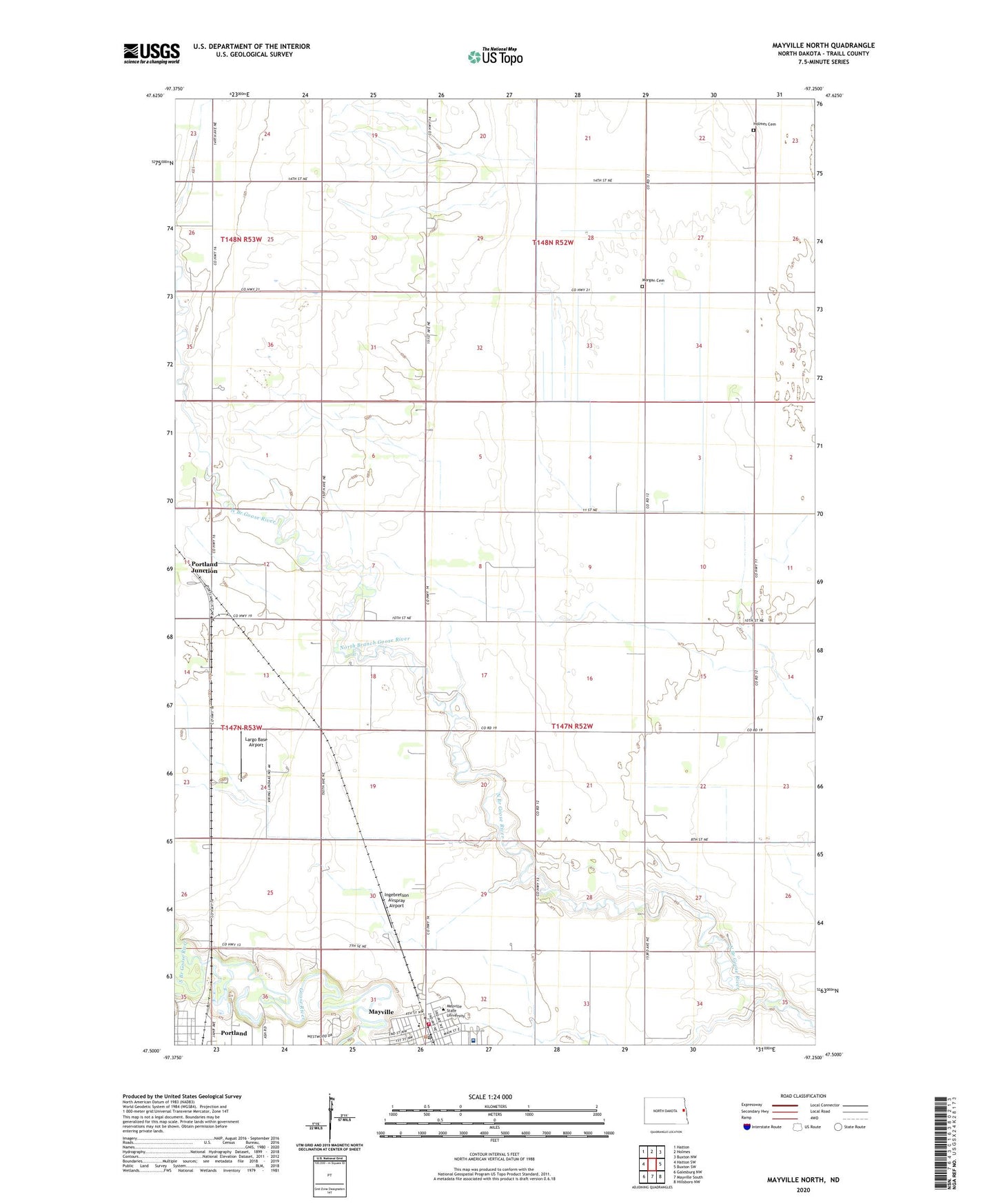
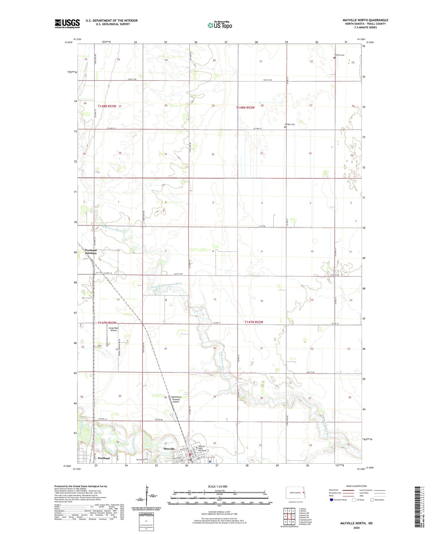
2020 topographic map quadrangle Mayville North in the state of North Dakota. Scale: 1:24000. Based on the newly updated USGS 7.5' US Topo map series, this map is in the following counties: Traill. The map contains contour data, water features, and other items you are used to seeing on USGS maps, but also has updated roads and other features. This is the next generation of topographic maps. Printed on high-quality waterproof paper with UV fade-resistant inks.
Quads adjacent to this one:
West: Hatton SW
Northwest: Hatton
North: Holmes
Northeast: Buxton NW
East: Buxton SW
Southeast: Hillsboro NW
South: Mayville South
Southwest: Galesburg NW
Contains the following named places: Agassiz Hall, Berg Hall, Birkelo Hall, Byrnes-Quanbeck Library, Campus Center, Children Development Center, Goose River Heritage Center Museum, Holmes Cemetery, Ingebretson Airspray Airport, Jerome Berg Field, Largo Base Airport, Lewy Lee Fieldhouse, Luther Memorial Home, Mayville City Hall, Mayville Fire Department, Mayville Golf Course, Mayville Medical Center, Mayville Police Department, Mayville Post Office, Mayville Public Library, Mayville State College, Morgan Cemetery, Northwest Hall, Old Main Building, Peter Boe Junior Elementary School, Portland Dam, Portland Junction, Science Building, Scott Berry Field, South Branch Goose River, Township of Garfield, Township of Lindaas, Veterans Memorial Stadium, Wellness Center, West Traill Ambulance Service