MyTopo
McVille North Dakota US Topo Map
Couldn't load pickup availability
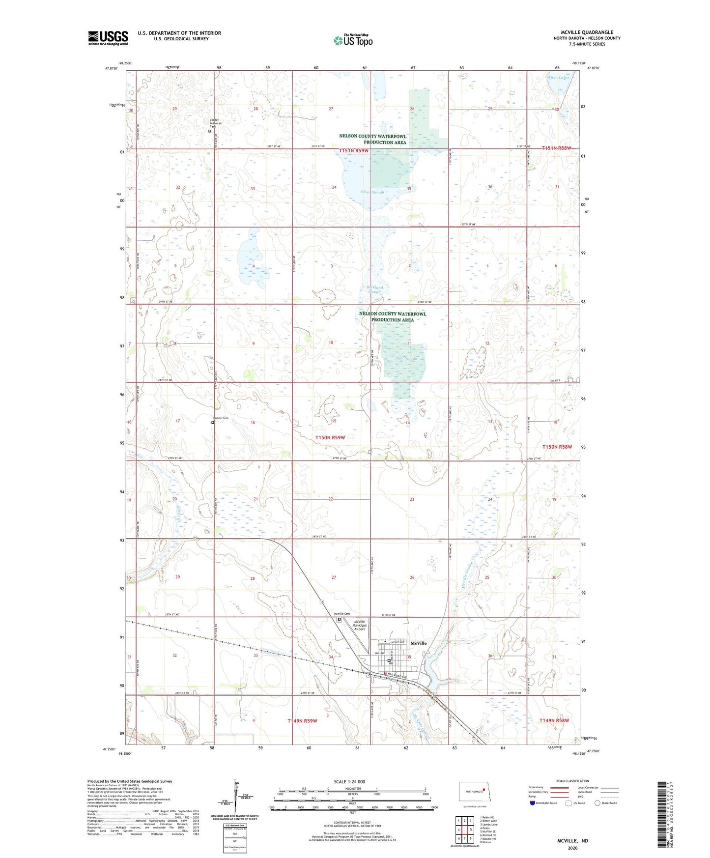
2024 topographic map quadrangle McVille in the state of North Dakota. Scale: 1:24000. Based on the newly updated USGS 7.5' US Topo map series, this map is in the following counties: Nelson. The map contains contour data, water features, and other items you are used to seeing on USGS maps, but also has updated roads and other features. This is the next generation of topographic maps. Printed on high-quality waterproof paper with UV fade-resistant inks.
Quads adjacent to this one:
West: Pekin
Northwest: Pekin NE
North: Bitter Lake
Northeast: Lambs Lake
East: McVille SE
Southeast: Kloten
South: Kloten NW
Southwest: Binford NE
This map covers the same area as the classic USGS quad with code o47098g2.
Contains the following named places: Berkland Slough, Center Church, Center Lutheran Cemetery, City of McVille, Dahl Slough, Dakota Prairie Elementary School, Hamlin Cemetery, McVille, McVille Cemetery, McVille City Auditorium, McVille City Hall, McVille Community Library, McVille Fire Department, McVille Municipal Airport, McVille Post Office, McVille Railroad Dam, Nelson County Health System Care Center, Nelson County Health System Hospital, Olsen Slough, Township of Hamlin, ZIP Code: 58254