MyTopo
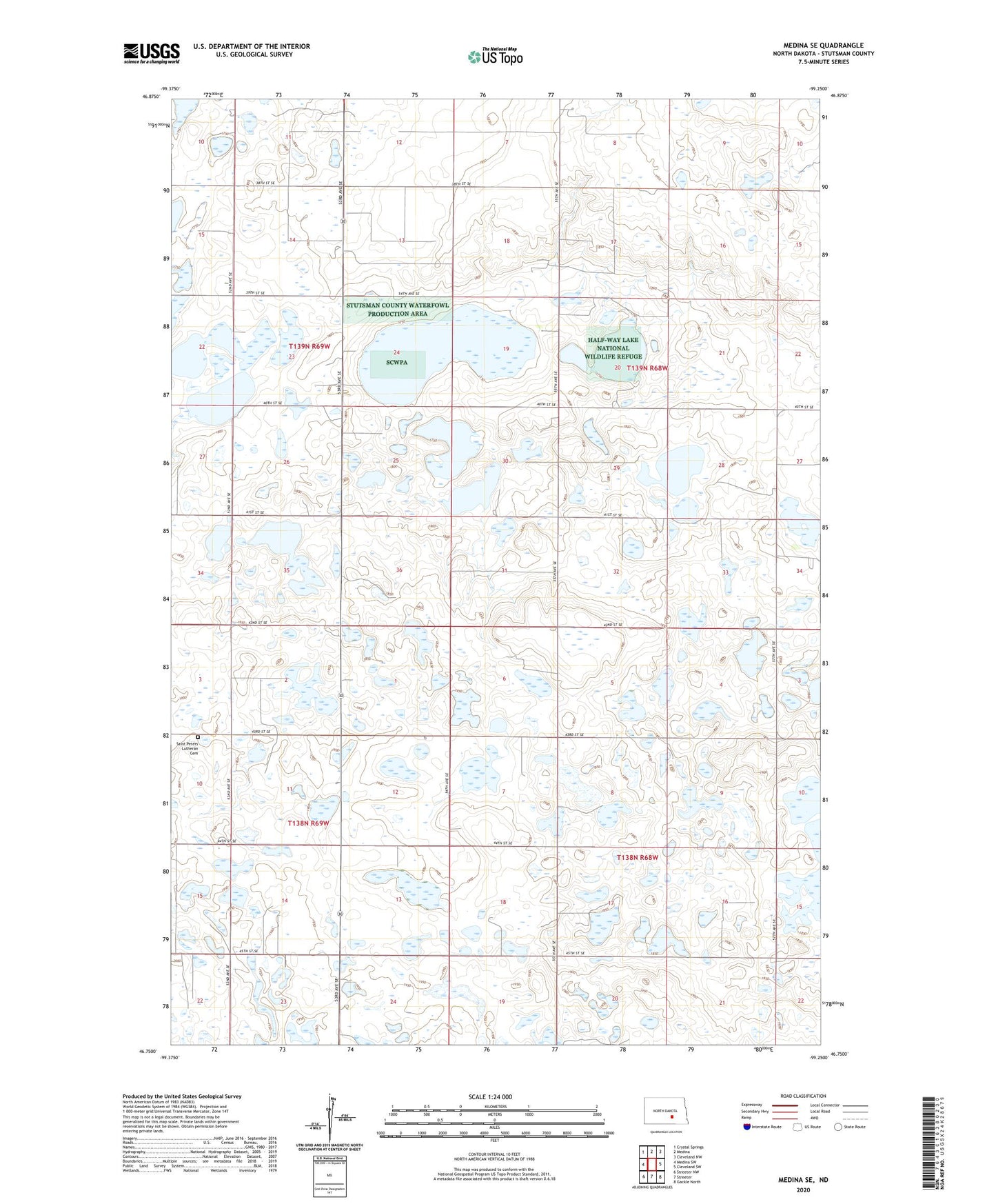
Medina SE North Dakota US Topo Map
Couldn't load pickup availability
2024 topographic map quadrangle Medina SE in the state of North Dakota. Scale: 1:24000. Based on the newly updated USGS 7.5' US Topo map series, this map is in the following counties: Stutsman. The map contains contour data, water features, and other items you are used to seeing on USGS maps, but also has updated roads and other features. This is the next generation of topographic maps. Printed on high-quality waterproof paper with UV fade-resistant inks.
Quads adjacent to this one:
West: Medina SW
Northwest: Crystal Springs
North: Medina
Northeast: Cleveland NW
East: Cleveland SW
Southeast: Gackle North
South: Streeter
Southwest: Streeter NW
This map covers the same area as the classic USGS quad with code o46099g3.
Contains the following named places: Half-Way Lake National Wildlife Refuge, Newbury Town Hall, Reformed Church, Rueb Dam, Saint Peters Lutheran Cemetery, School Number 1, School Number 2, Township of Bloomenfield, Township of Chicago