MyTopo
Menoken SW North Dakota US Topo Map
Couldn't load pickup availability
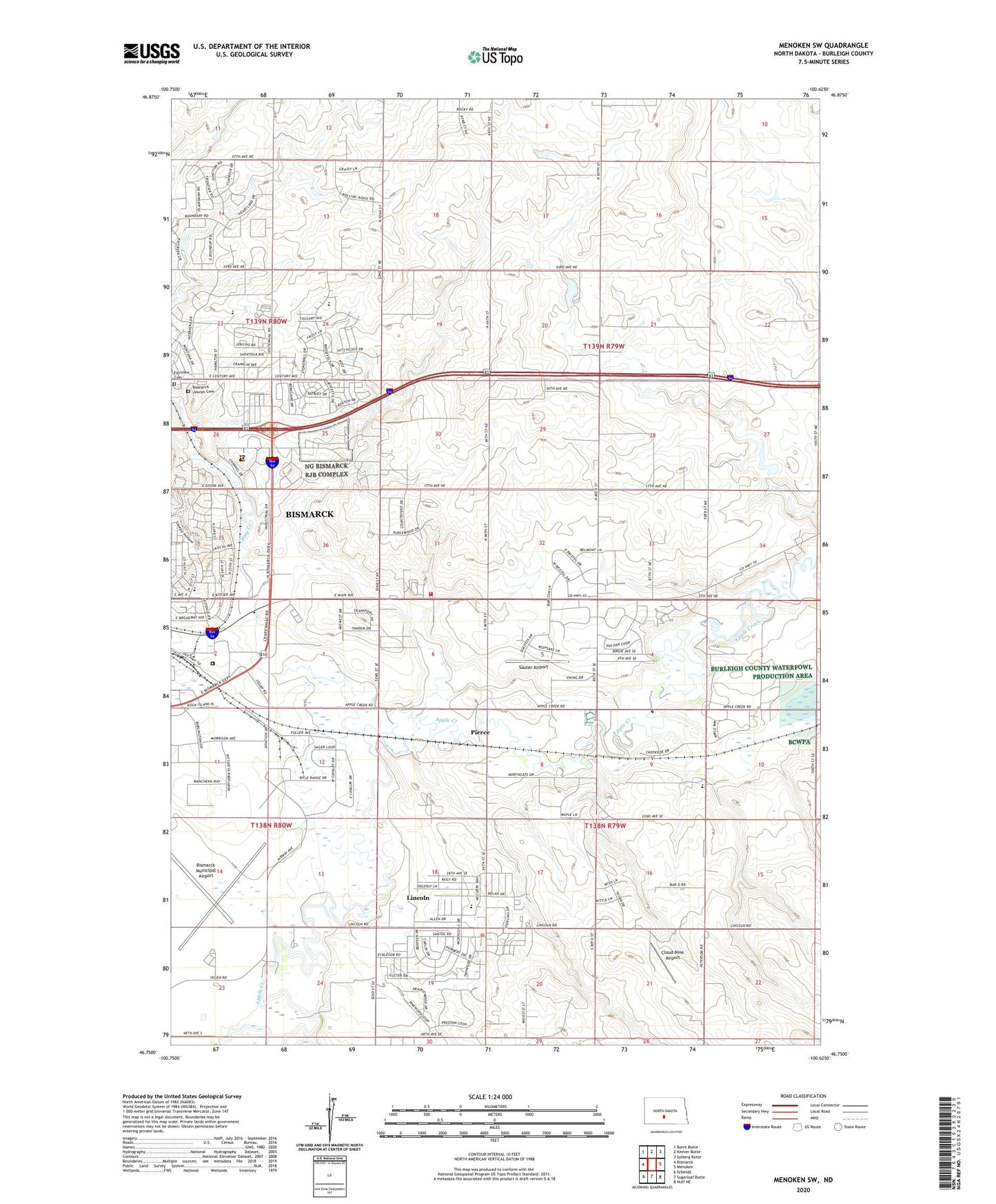
2024 topographic map quadrangle Menoken SW in the state of North Dakota. Scale: 1:24000. Based on the newly updated USGS 7.5' US Topo map series, this map is in the following counties: Burleigh. The map contains contour data, water features, and other items you are used to seeing on USGS maps, but also has updated roads and other features. This is the next generation of topographic maps. Printed on high-quality waterproof paper with UV fade-resistant inks.
Quads adjacent to this one:
West: Bismarck
Northwest: Burnt Butte
North: Keever Butte
Northeast: Solberg Butte
East: Menoken
Southeast: Huff NE
South: Sugarloaf Butte
Southwest: Schmidt
This map covers the same area as the classic USGS quad with code o46100g6.
Contains the following named places: Apple Creek Country Club, Apple Creek School, Bismarck Jewish Cemetery, Bismarck Rural Fire Department, Buckstop Junction Historic Village, Calvary United Methodist Church, Capital Christian Center, City of Lincoln, Cloud Nine Airport, Cypert Park, Fairview Cemetery, Hay Creek, Hillcrest Acres, Lincoln, Lincoln City Hall, Lincoln Police Department, McDowell Dam, Mister Bs Estates, North Dakota State Penitentiary, Pierce, Rita Murphy Elementary School, Sauter Airport, School Number 1, Sunrise Elementary School, Township of Apple Creek, Township of Gibbs, Wilson School, Yegen Dam, ZIP Code: 58501