MyTopo
North Killdeer Mountain North Dakota US Topo Map
Couldn't load pickup availability
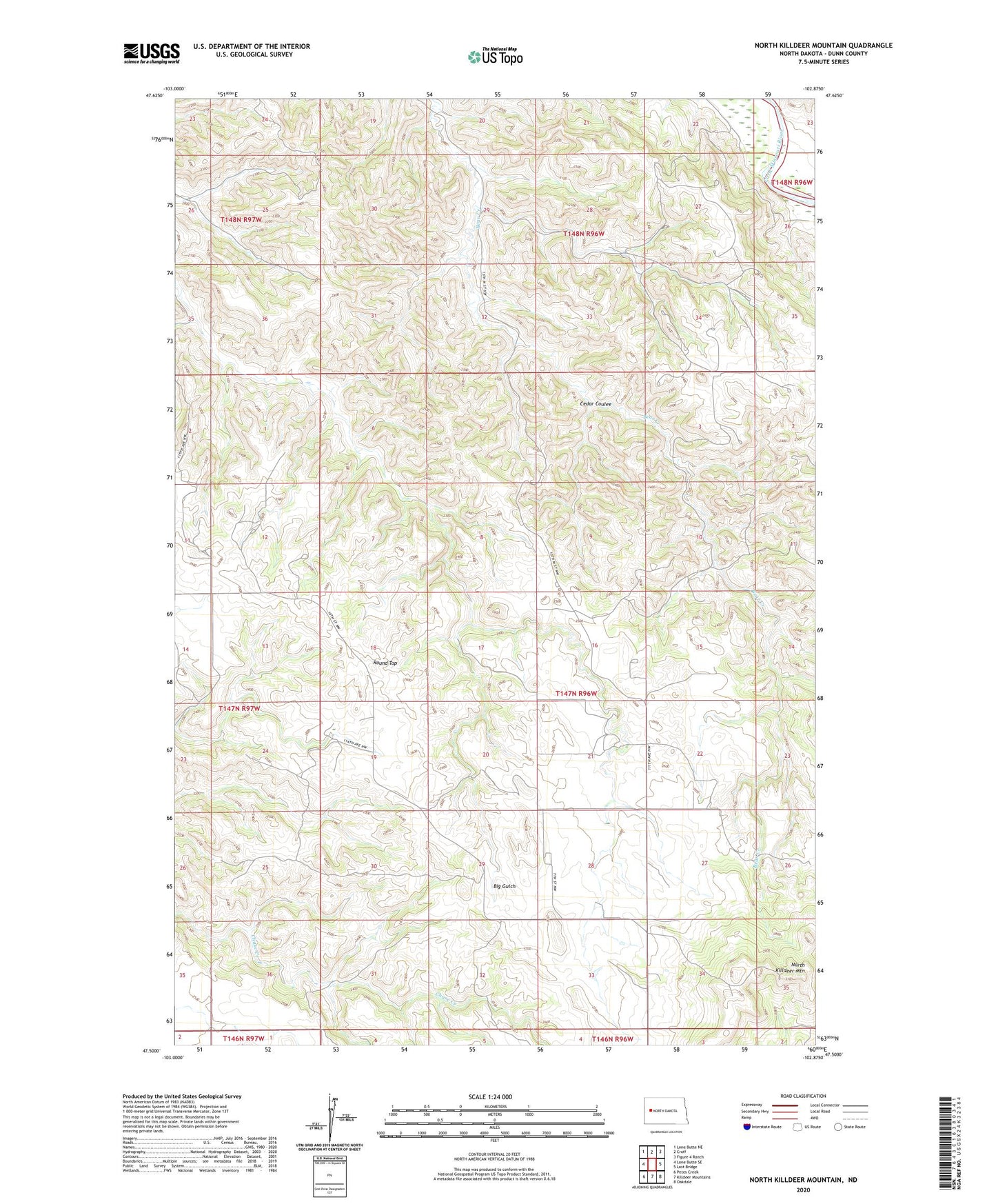
2024 topographic map quadrangle North Killdeer Mountain in the state of North Dakota. Scale: 1:24000. Based on the newly updated USGS 7.5' US Topo map series, this map is in the following counties: Dunn. The map contains contour data, water features, and other items you are used to seeing on USGS maps, but also has updated roads and other features. This is the next generation of topographic maps. Printed on high-quality waterproof paper with UV fade-resistant inks.
Quads adjacent to this one:
West: Lone Butte SE
Northwest: Lone Butte NE
North: Croff
Northeast: Figure 4 Ranch
East: Lost Bridge
Southeast: Oakdale
South: Killdeer Mountains
Southwest: Petes Creek
This map covers the same area as the classic USGS quad with code o47102e8.
Contains the following named places: Benson Ranch, Bice Ranch, Brown Ranch, Cedar Coulee, Hanson Ranch, Hawkinson Ranch, North Killdeer Mountain, Pelton Ranch, Peterson Ranch, Pletan Ranch, Round Top, Sandvick Ranch