MyTopo
Pelican Lake North Dakota US Topo Map
Couldn't load pickup availability
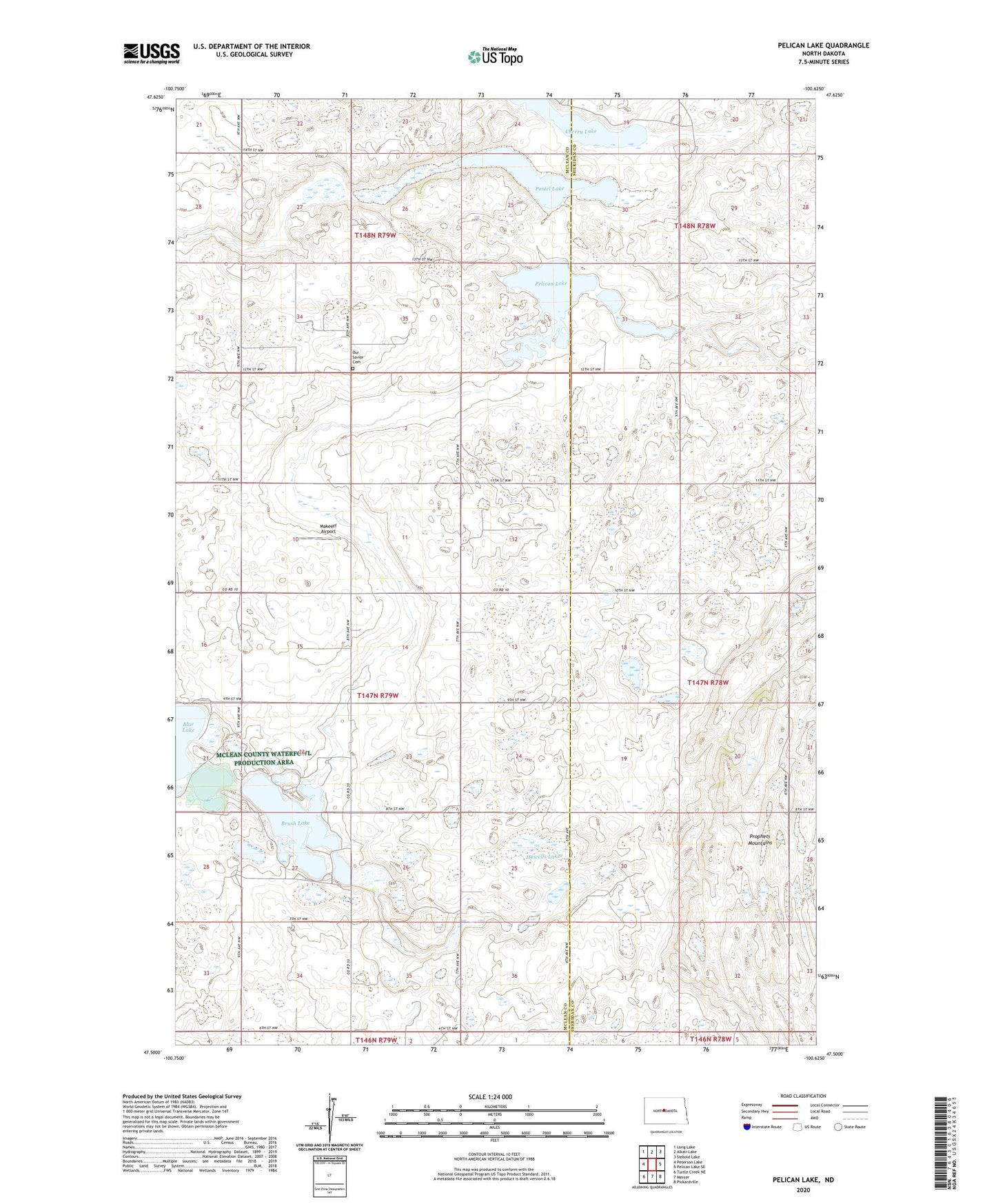
2024 topographic map quadrangle Pelican Lake in the state of North Dakota. Scale: 1:24000. Based on the newly updated USGS 7.5' US Topo map series, this map is in the following counties: McLean, Sheridan. The map contains contour data, water features, and other items you are used to seeing on USGS maps, but also has updated roads and other features. This is the next generation of topographic maps. Printed on high-quality waterproof paper with UV fade-resistant inks.
Quads adjacent to this one:
West: Peterson Lake
Northwest: Long Lake
North: Alkali Lake
Northeast: Siebold Lake
East: Pelican Lake SE
Southeast: Pickardville
South: Mercer
Southwest: Turtle Creek NE
This map covers the same area as the classic USGS quad with code o47100e6.
Contains the following named places: Brush Lake, Cherry Lake, Howells Lake, Makeeff Airport, Our Savior Cemetery, Pelican Lake, Postel Lake, Prophets Mountains, School Number 1, School Number 3, Township of Wise