MyTopo
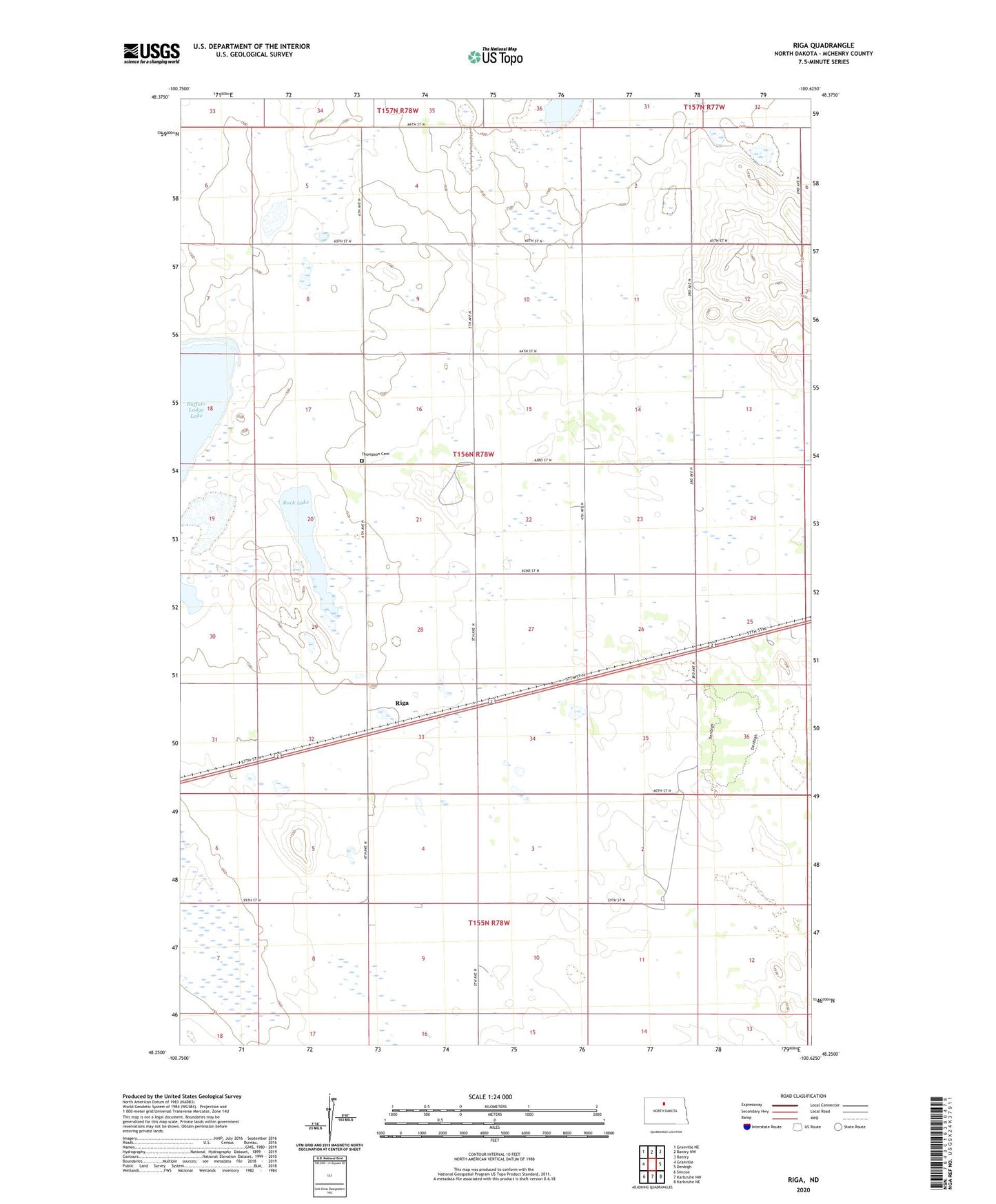
Riga North Dakota US Topo Map
Couldn't load pickup availability
Also explore the Riga Forest Service Topo of this same quad for updated USFS data
2024 topographic map quadrangle Riga in the state of North Dakota. Scale: 1:24000. Based on the newly updated USGS 7.5' US Topo map series, this map is in the following counties: McHenry. The map contains contour data, water features, and other items you are used to seeing on USGS maps, but also has updated roads and other features. This is the next generation of topographic maps. Printed on high-quality waterproof paper with UV fade-resistant inks.
Quads adjacent to this one:
West: Granville
Northwest: Granville NE
North: Bantry NW
Northeast: Bantry
East: Denbigh
Southeast: Karlsruhe NE
South: Karlsruhe NW
Southwest: Simcoe
This map covers the same area as the classic USGS quad with code o48100c6.
Contains the following named places: Denbigh Experimental Forest, Indiana School, Riga, Riga School, Rock Lake, Rose Hill School, Thompson Cemetery, Township of Riga, White Rock School