MyTopo
Bantry North Dakota US Topo Map
Couldn't load pickup availability
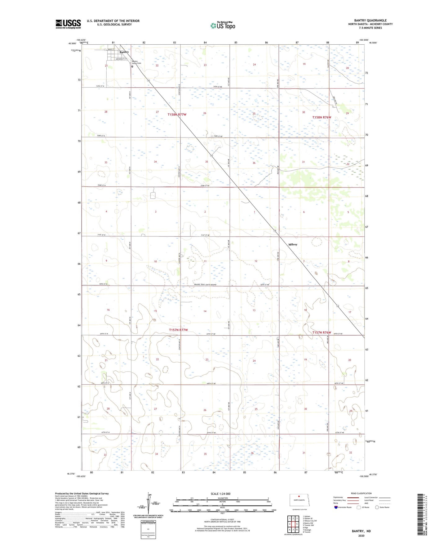
2024 topographic map quadrangle Bantry in the state of North Dakota. Scale: 1:24000. Based on the newly updated USGS 7.5' US Topo map series, this map is in the following counties: McHenry. The map contains contour data, water features, and other items you are used to seeing on USGS maps, but also has updated roads and other features. This is the next generation of topographic maps. Printed on high-quality waterproof paper with UV fade-resistant inks.
Quads adjacent to this one:
West: Bantry NW
Northwest: Upham
North: Upham SE
Northeast: Willow City SW
East: Towner NW
Southeast: Towner
South: Denbigh
Southwest: Riga
This map covers the same area as the classic USGS quad with code o48100d5.
Contains the following named places: Bantry, Bantry Census Designated Place, Bantry Post Office, Bantry Union Cemetery, City of Bantry, Medicine Lodge School Number 1, Medicine Lodge School Number 3, Milroy, Township of Wagar