MyTopo
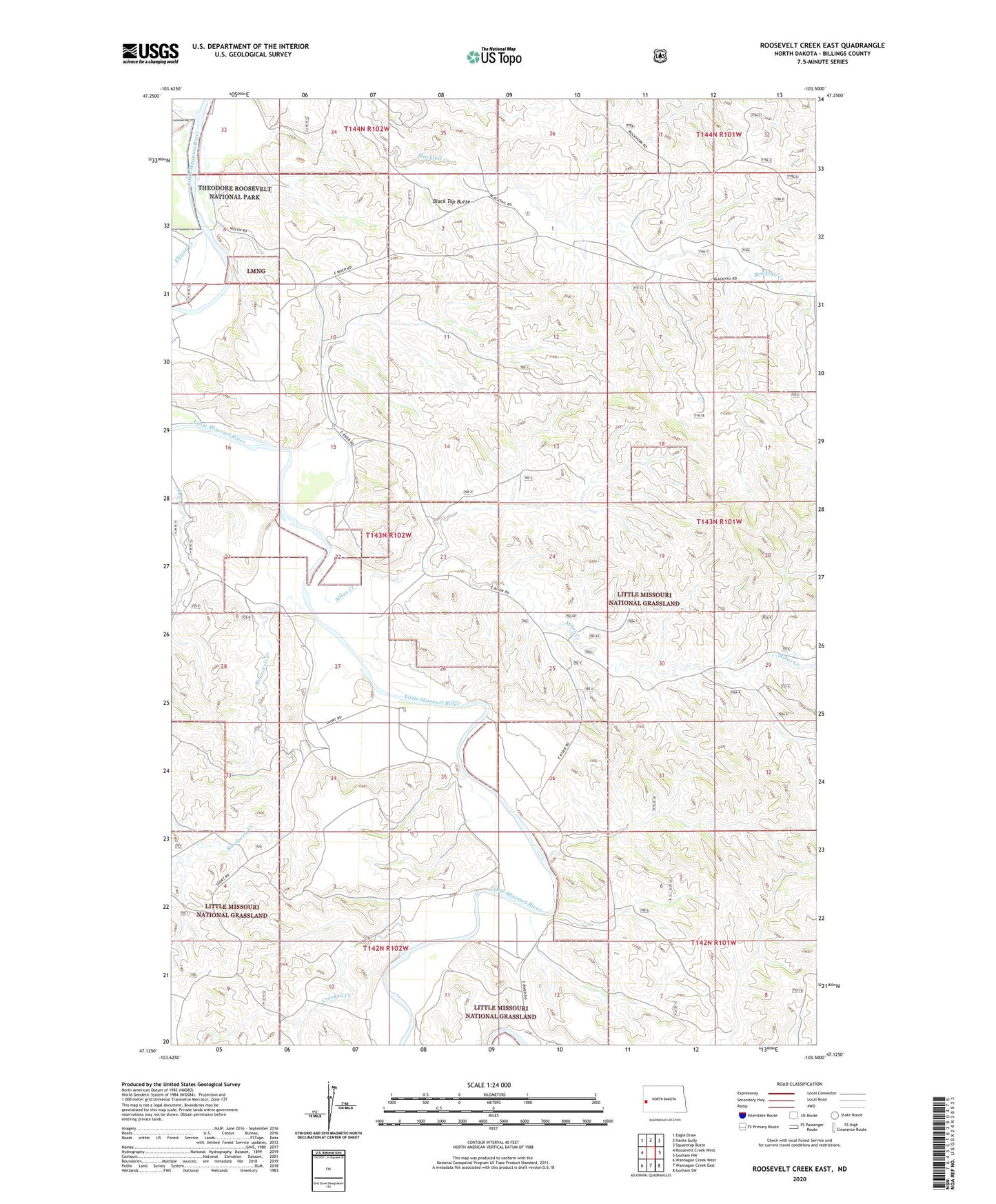
Roosevelt Creek East North Dakota US Topo Map
Couldn't load pickup availability
Also explore the Roosevelt Creek East Forest Service Topo of this same quad for updated USFS data
2024 topographic map quadrangle Roosevelt Creek East in the state of North Dakota. Scale: 1:24000. Based on the newly updated USGS 7.5' US Topo map series, this map is in the following counties: Billings. The map contains contour data, water features, and other items you are used to seeing on USGS maps, but also has updated roads and other features. This is the next generation of topographic maps. Printed on high-quality waterproof paper with UV fade-resistant inks.
Quads adjacent to this one:
West: Roosevelt Creek West
Northwest: Eagle Draw
North: Hanks Gully
Northeast: Squaretop Butte
East: Gorham NW
Southeast: Gorham SW
South: Wannagan Creek East
Southwest: Wannagan Creek West
This map covers the same area as the classic USGS quad with code o47103b5.
Contains the following named places: Badlands Scenic Area, Black Top Butte, Buckhorn Ranch, Crooked Creek, Elkhorn Substation, Ellison Creek, Little Missouri National Grassland, Mikes Creek, Mosser Ranch, Roosevelt Creek, Short Ranch