MyTopo
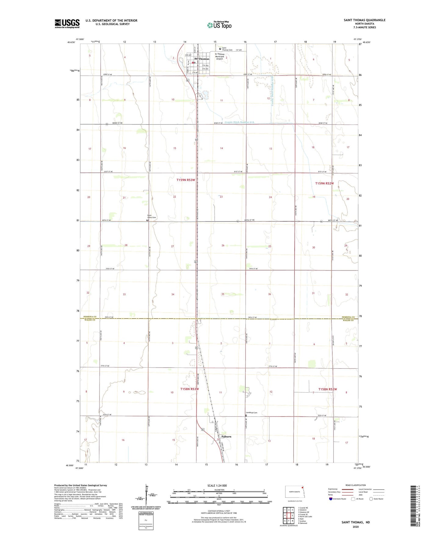
Saint Thomas North Dakota US Topo Map
Couldn't load pickup availability
2024 topographic map quadrangle Saint Thomas in the state of North Dakota. Scale: 1:24000. Based on the newly updated USGS 7.5' US Topo map series, this map is in the following counties: Pembina, Walsh. The map contains contour data, water features, and other items you are used to seeing on USGS maps, but also has updated roads and other features. This is the next generation of topographic maps. Printed on high-quality waterproof paper with UV fade-resistant inks.
Quads adjacent to this one:
West: Crystal SE
Northwest: Crystal NE
North: Glasston
Northeast: Glasston NE
East: North Salt Lake
Southeast: Oakwood
South: Grafton
Southwest: Nash
This map covers the same area as the classic USGS quad with code o48097e4.
Contains the following named places: Auburn, Auburn Census Designated Place, City of Saint Thomas, County Ditch Number 67A, County Ditch Number 67D, Landstad Cemetery, Saint Johns Cemetery, Saint Thomas, Saint Thomas City Cemetery, Saint Thomas Fire Protection District Station, Saint Thomas Post Office, Saint Thomas Public School, St Thomas Municipal Airport