MyTopo
Grafton North Dakota US Topo Map
Couldn't load pickup availability
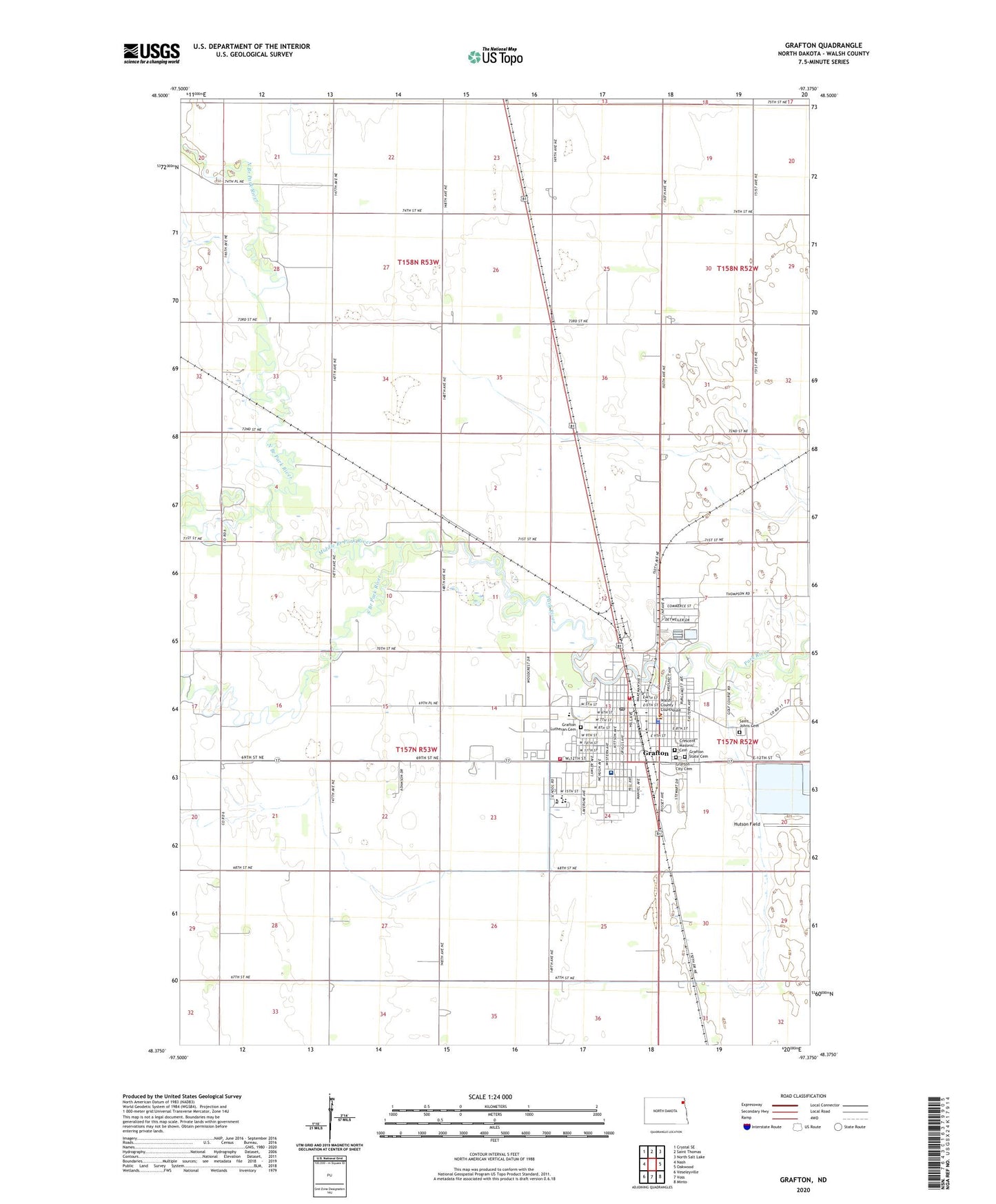
2024 topographic map quadrangle Grafton in the state of North Dakota. Scale: 1:24000. Based on the newly updated USGS 7.5' US Topo map series, this map is in the following counties: Walsh. The map contains contour data, water features, and other items you are used to seeing on USGS maps, but also has updated roads and other features. This is the next generation of topographic maps. Printed on high-quality waterproof paper with UV fade-resistant inks.
Quads adjacent to this one:
West: Nash
Northwest: Crystal SE
North: Saint Thomas
Northeast: North Salt Lake
East: Oakwood
Southeast: Minto
South: Voss
Southwest: Veseleyville
This map covers the same area as the classic USGS quad with code o48097d4.
Contains the following named places: Carnegie Regional Library, Century Elementary School, Chase School, City of Grafton, Crescent Masonic Cemetery, Deaconess Hospital, Grafton, Grafton Central Middle School, Grafton City Cemetery, Grafton City Fire Department 2, Grafton City Hall, Grafton Dam, Grafton Fire Station 1, Grafton High School, Grafton Lutheran Cemetery, Grafton Police Department, Grafton Post Office, Grafton State Cemetery, Heritage Village and Jugville Museum, Historic Elmwood House Museum, KXPO-AM (Grafton), Leistikow Memorial Park, Lutheran Sunset Home, Middle Branch Park River, North Branch Park River, Saint Johns Cemetery, South Branch Park River, Township of Farmington, Township of Grafton, Unity Medical Center, Valley Ambulance and Rescue Service, Vigness Dam, Walsh County Courthouse, Walsh County Jail, Walsh County Sheriff's Office, Western Plaza, ZIP Code: 58237