
MyTopo
Schafer SE North Dakota US Topo Map
Couldn't load pickup availability
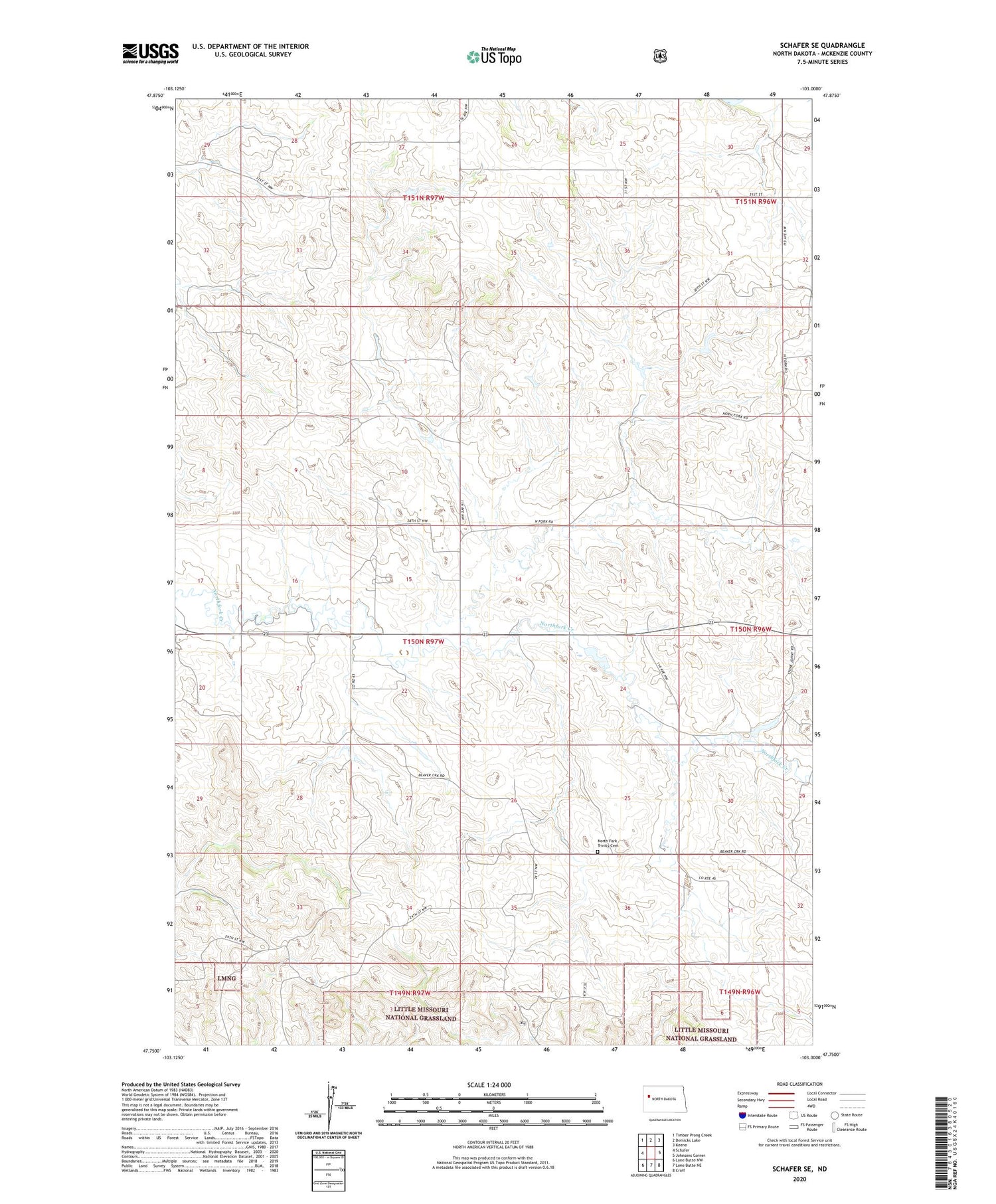
2020 topographic map quadrangle Schafer SE in the state of North Dakota. Scale: 1:24000. Based on the newly updated USGS 7.5' US Topo map series, this map is in the following counties: McKenzie. The map contains contour data, water features, and other items you are used to seeing on USGS maps, but also has updated roads and other features. This is the next generation of topographic maps. Printed on high-quality waterproof paper with UV fade-resistant inks.
Quads adjacent to this one:
West: Schafer
Northwest: Timber Prong Creek
North: Demicks Lake
Northeast: Keene
East: Johnsons Corner
Southeast: Croff
South: Lone Butte NE
Southwest: Lone Butte NW
Contains the following named places: D Jorgenson Ranch, Jore Water Well, North Fork Trinity Cemetery, R Jore Ranch, Siverston Dam, Township of Bear Den, Wallace County


