MyTopo
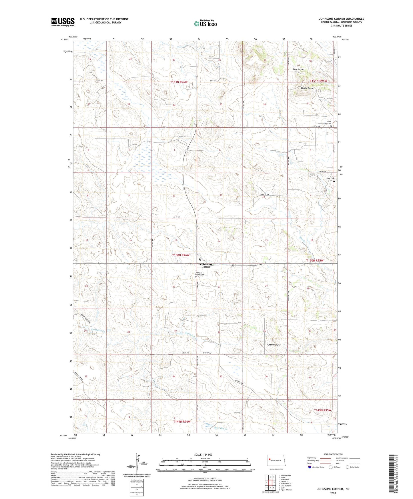
Johnsons Corner North Dakota US Topo Map
Couldn't load pickup availability
Also explore the Johnsons Corner Forest Service Topo of this same quad for updated USFS data
2024 topographic map quadrangle Johnsons Corner in the state of North Dakota. Scale: 1:24000. Based on the newly updated USGS 7.5' US Topo map series, this map is in the following counties: McKenzie. The map contains contour data, water features, and other items you are used to seeing on USGS maps, but also has updated roads and other features. This is the next generation of topographic maps. Printed on high-quality waterproof paper with UV fade-resistant inks.
Quads adjacent to this one:
West: Schafer SE
Northwest: Demicks Lake
North: Keene
Northeast: Blue Buttes
East: Blue Buttes SE
Southeast: Figure 4 Ranch
South: Croff
Southwest: Lone Butte NE
This map covers the same area as the classic USGS quad with code o47102g8.
Contains the following named places: Camel Buttes Oil and Gas Field, Johnson Corner School, Johnson Corners Christian Academy, Johnsons Corner, Johnsons Corner Cemetery, Kummer Ridge, Pershing Oil and Gas Field, Saddle Butte, Silent City Cemetery, Union Cemetery