MyTopo
Scranton North Dakota US Topo Map
Couldn't load pickup availability
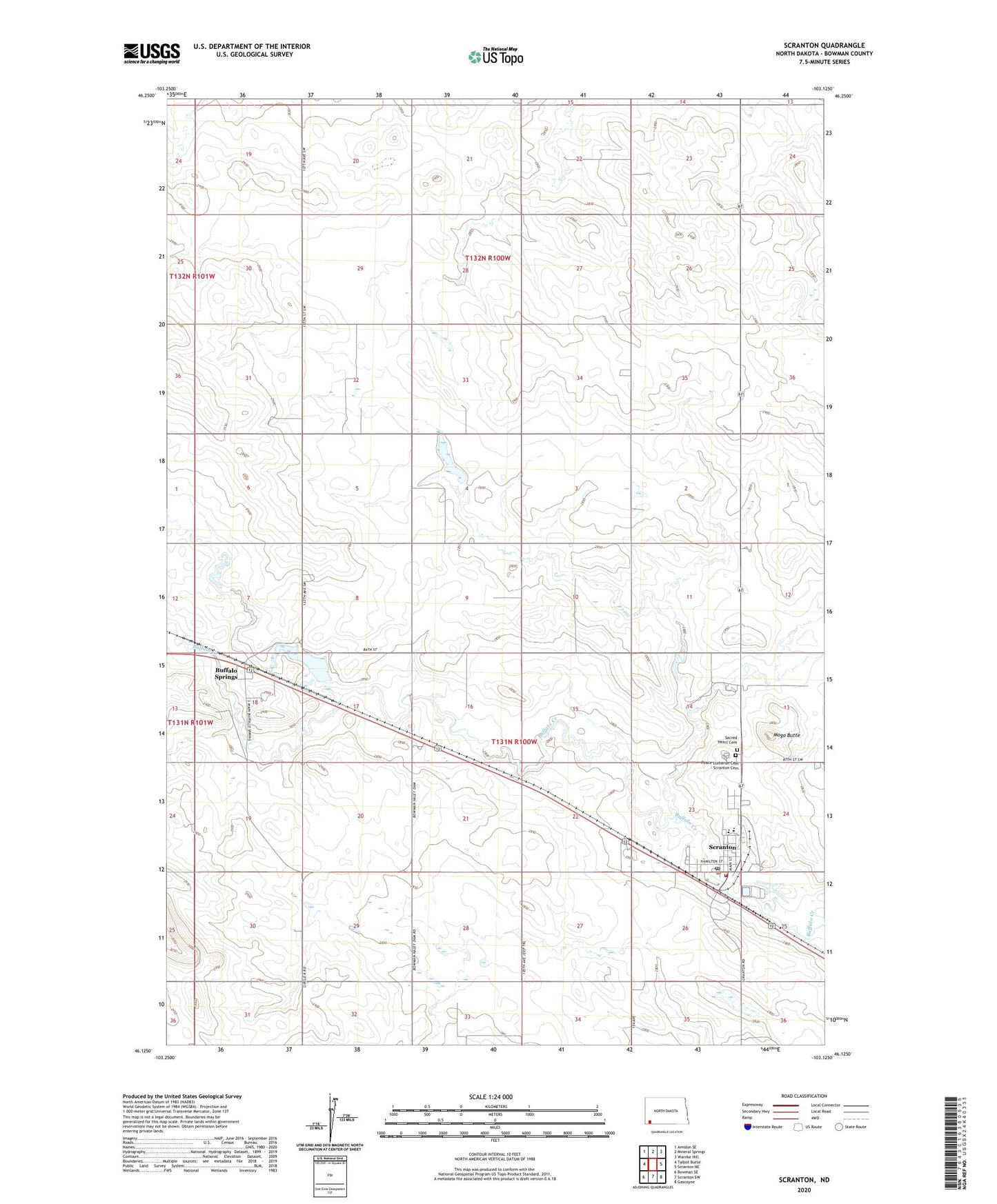
2024 topographic map quadrangle Scranton in the state of North Dakota. Scale: 1:24000. Based on the newly updated USGS 7.5' US Topo map series, this map is in the following counties: Bowman. The map contains contour data, water features, and other items you are used to seeing on USGS maps, but also has updated roads and other features. This is the next generation of topographic maps. Printed on high-quality waterproof paper with UV fade-resistant inks.
Quads adjacent to this one:
West: Talbot Butte
Northwest: Amidon SE
North: Mineral Springs
Northeast: Warnke Hill
East: Scranton NE
Southeast: Gascoyne
South: Scranton SW
Southwest: Bowman SE
This map covers the same area as the classic USGS quad with code o46103b2.
Contains the following named places: Buffalo Springs, Buffalo Springs Dam, Buffalo Springs Lake, City of Scranton, Fisher Field, Moga Butte, Peace Lutheran Cemetery - Scranton Cemetery, Sacred Heart Cemetery, Scranton, Scranton City Hall, Scranton Fire Protection District Station, Scranton Police Department, Scranton Post Office, Scranton Public School, Township of Scranton, Township of Stillwater