MyTopo
Steele North Dakota US Topo Map
Couldn't load pickup availability
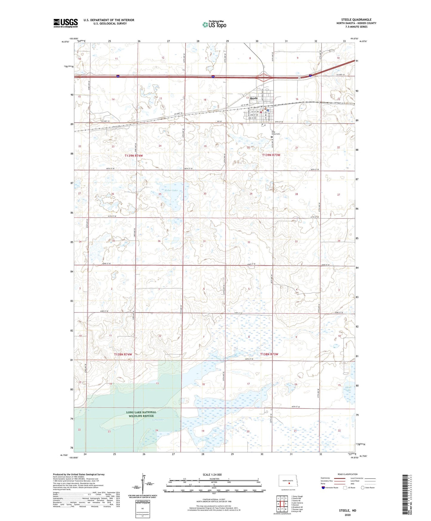
2024 topographic map quadrangle Steele in the state of North Dakota. Scale: 1:24000. Based on the newly updated USGS 7.5' US Topo map series, this map is in the following counties: Kidder. The map contains contour data, water features, and other items you are used to seeing on USGS maps, but also has updated roads and other features. This is the next generation of topographic maps. Printed on high-quality waterproof paper with UV fade-resistant inks.
Quads adjacent to this one:
West: Lake Geneva
Northwest: Stony Slough
North: Steele NW
Northeast: Steele NE
East: Dawson
Southeast: Kintyre NE
South: Pursian Lake
Southwest: Braddock NE
This map covers the same area as the classic USGS quad with code o46099g8.
Contains the following named places: City of Steele, Holy Cross Cemetery, Kidder County Ambulance Service, Kidder County Courthouse, Kidder County Library, Kidder County Museum, Kidder County Sheriff's Office, School Number 2, School Number 3, Steele, Steele City Hall, Steele Community Center, Steele Municipal Airport, Steele Police Department, Steele Post Office, Steele Volunteer Fire Station and Ambulance Service, Steele-Dawson Public School, Township of Woodlawn, Weber Lake, ZIP Code: 58482