MyTopo
Steele NE North Dakota US Topo Map
Couldn't load pickup availability
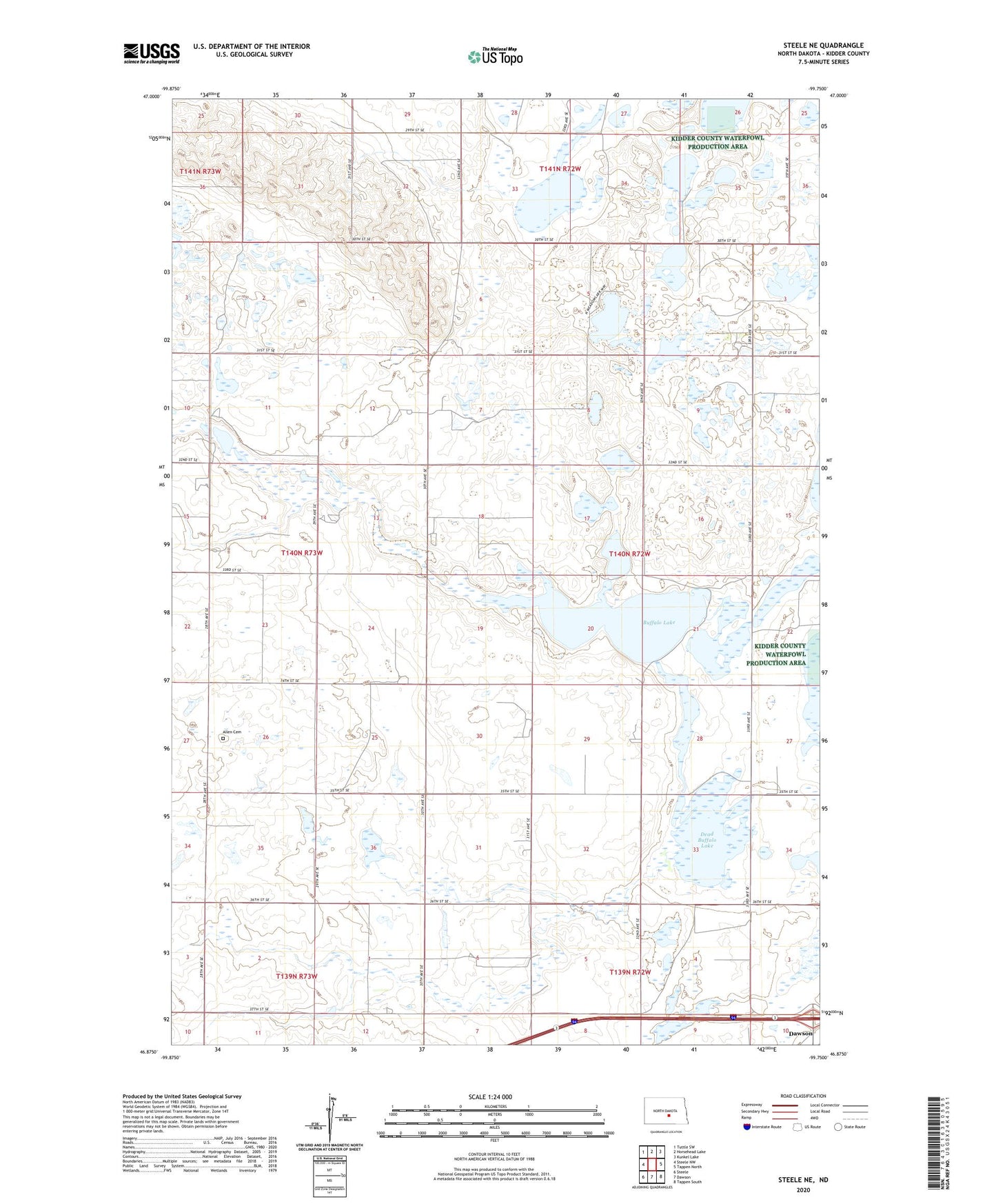
2024 topographic map quadrangle Steele NE in the state of North Dakota. Scale: 1:24000. Based on the newly updated USGS 7.5' US Topo map series, this map is in the following counties: Kidder. The map contains contour data, water features, and other items you are used to seeing on USGS maps, but also has updated roads and other features. This is the next generation of topographic maps. Printed on high-quality waterproof paper with UV fade-resistant inks.
Quads adjacent to this one:
West: Steele NW
Northwest: Tuttle SW
North: Horsehead Lake
Northeast: Kunkel Lake
East: Tappen North
Southeast: Tappen South
South: Dawson
Southwest: Steele
This map covers the same area as the classic USGS quad with code o46099h7.
Contains the following named places: Allen Cemetery, Buffalo Lake, Dead Buffalo Lake, Kidder County, School Number 1, School Number 2, Township of Vernon