MyTopo
Timber Prong Creek North Dakota US Topo Map
Couldn't load pickup availability
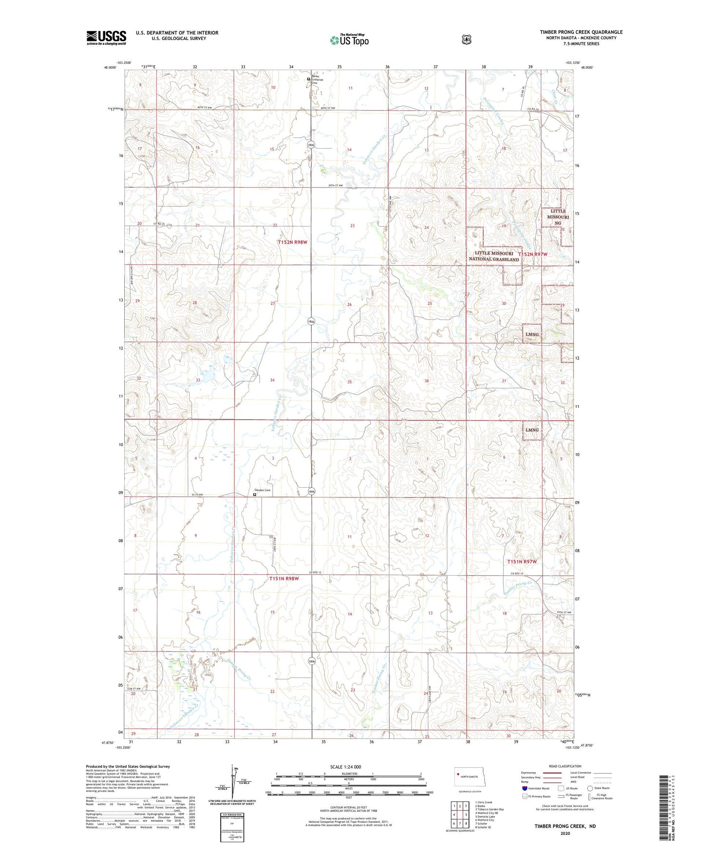
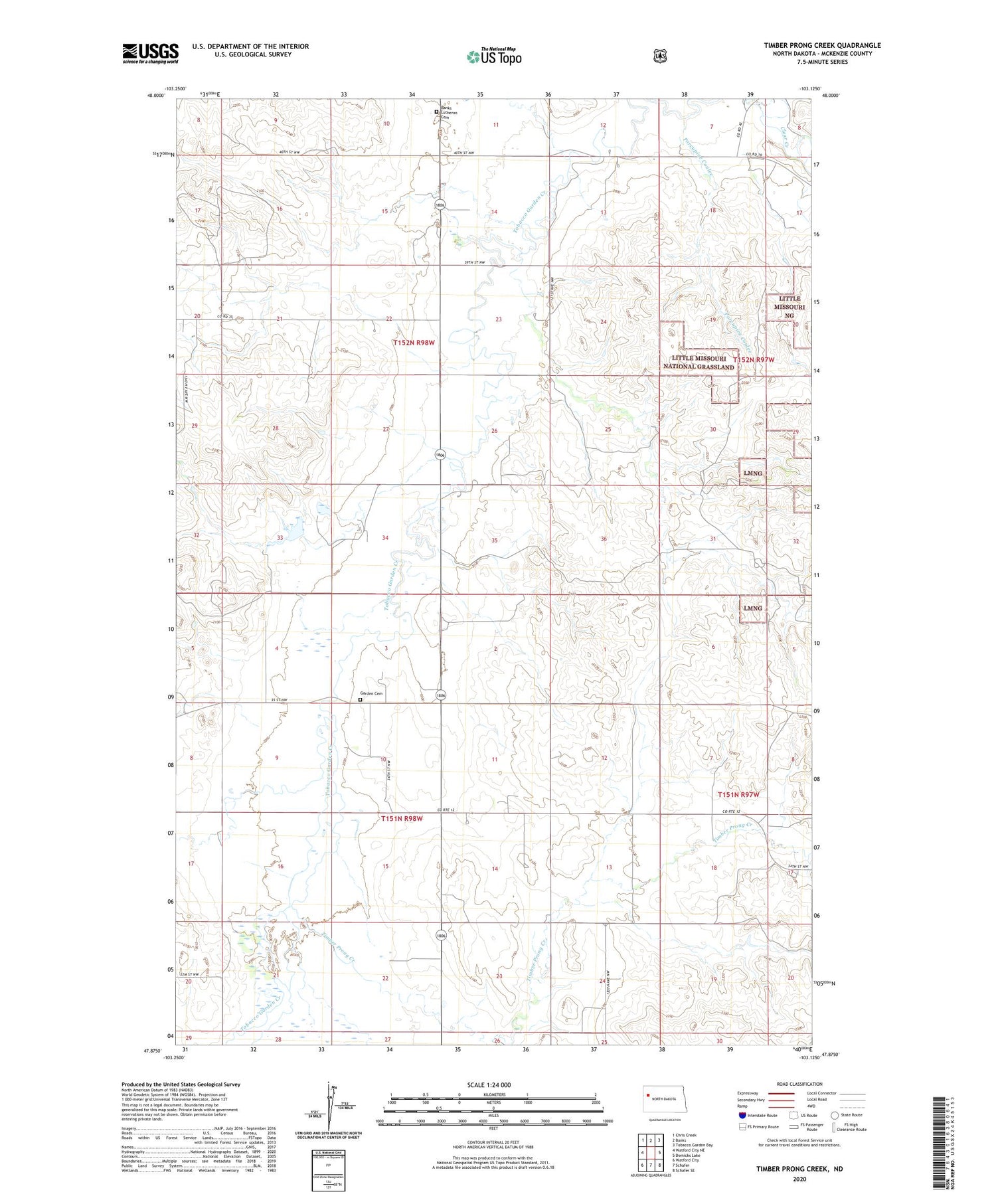
2020 topographic map quadrangle Timber Prong Creek in the state of North Dakota. Scale: 1:24000. Based on the newly updated USGS 7.5' US Topo map series, this map is in the following counties: McKenzie. The map contains contour data, water features, and other items you are used to seeing on USGS maps, but also has updated roads and other features. This is the next generation of topographic maps. Printed on high-quality waterproof paper with UV fade-resistant inks.
Quads adjacent to this one:
West: Watford City NE
Northwest: Chris Creek
North: Banks
Northeast: Tobacco Garden Bay
East: Demicks Lake
Southeast: Schafer SE
South: Schafer
Southwest: Watford City
Contains the following named places: Banks Church, Banks Lutheran Cemetery, Garden Cemetery, Garden Church, Porcupine Coulee, T Kellogg Ranch, Timber Prong Creek