MyTopo
Towner North Dakota US Topo Map
Couldn't load pickup availability
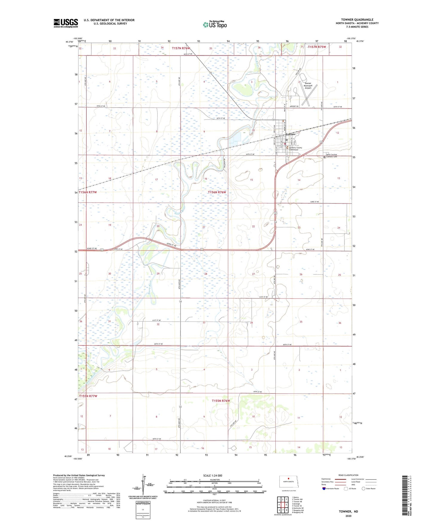
2024 topographic map quadrangle Towner in the state of North Dakota. Scale: 1:24000. Based on the newly updated USGS 7.5' US Topo map series, this map is in the following counties: McHenry. The map contains contour data, water features, and other items you are used to seeing on USGS maps, but also has updated roads and other features. This is the next generation of topographic maps. Printed on high-quality waterproof paper with UV fade-resistant inks.
Quads adjacent to this one:
West: Denbigh
Northwest: Bantry
North: Towner NW
Northeast: Towner NE
East: Towner SE
Southeast: Rangeley NE
South: Rangeley NW
Southwest: Karlsruhe NE
This map covers the same area as the classic USGS quad with code o48100c4.
Contains the following named places: City of Towner, Cooperdahl Hill School Number 1, Eaton Dam, McHenry County Courthouse, McHenry County Sheriff's Office, Saint Cecilias Catholic Cemetery, TGU Towner Public School, Towner, Towner City Hall, Towner Fire Station, Towner Municipal Airport, Towner Post Office, Towner State Nursery, Township of Newport, ZIP Code: 58788