MyTopo
Trenton North Dakota US Topo Map
Couldn't load pickup availability
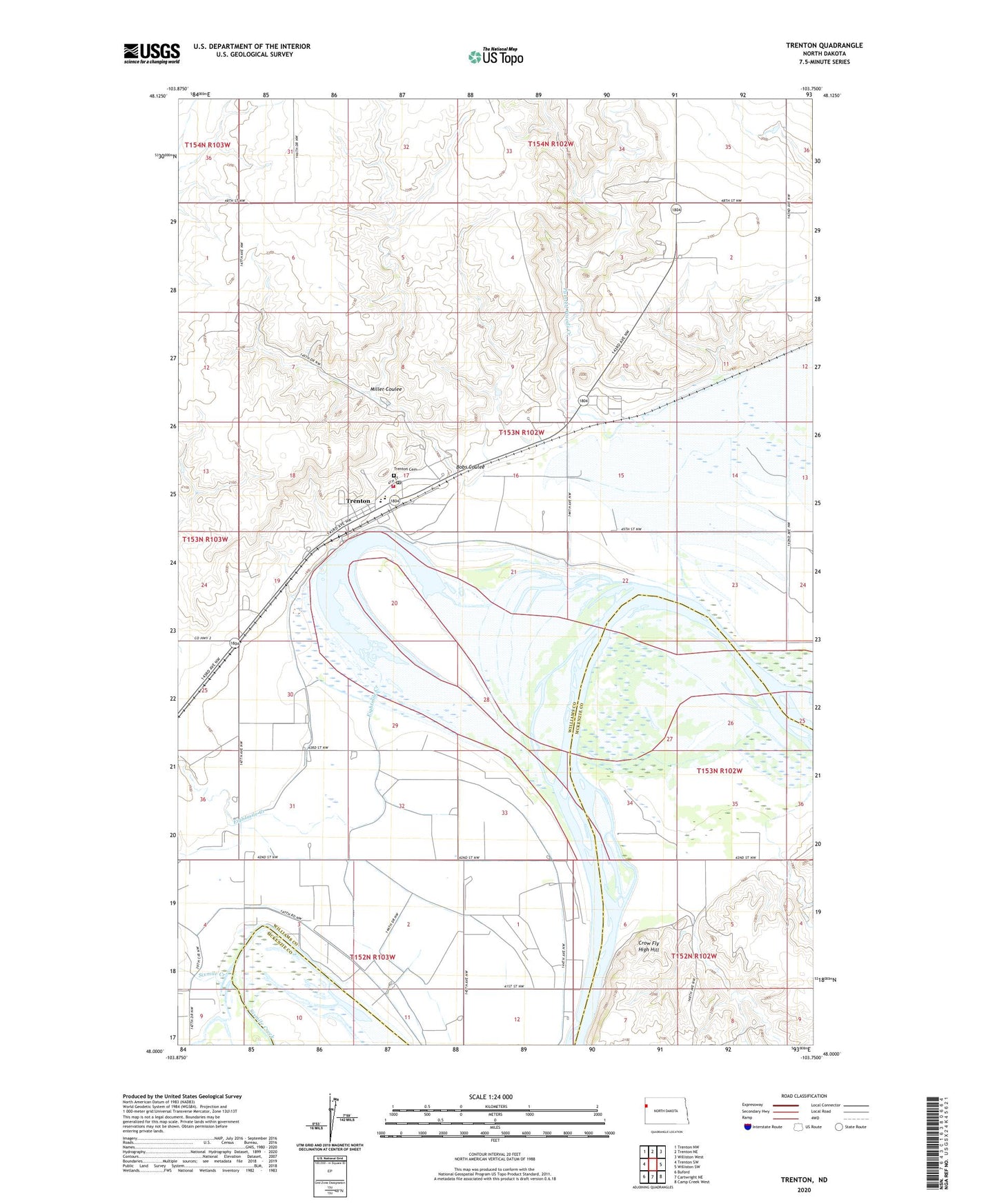
2024 topographic map quadrangle Trenton in the state of North Dakota. Scale: 1:24000. Based on the newly updated USGS 7.5' US Topo map series, this map is in the following counties: Williams, McKenzie. The map contains contour data, water features, and other items you are used to seeing on USGS maps, but also has updated roads and other features. This is the next generation of topographic maps. Printed on high-quality waterproof paper with UV fade-resistant inks.
Quads adjacent to this one:
West: Trenton SW
Northwest: Trenton NW
North: Trenton NE
Northeast: Williston West
East: Williston SW
Southeast: Camp Creek West
South: Cartwright NE
Southwest: Buford
This map covers the same area as the classic USGS quad with code o48103a7.
Contains the following named places: Bobs Coulee, Crow Fly High Hill, Eight Mile Public School, Eightmile Creek, Lake Trenton, Lake Trenton Pumping Station, Miller Coulee, Painted Woods Creek, Sixmile Creek, Township of Trenton, Trenton, Trenton Cemetery, Trenton Census Designated Place, Trenton Fire Station, Trenton Post Office, Trenton Public Use Area, ZIP Code: 58853