MyTopo
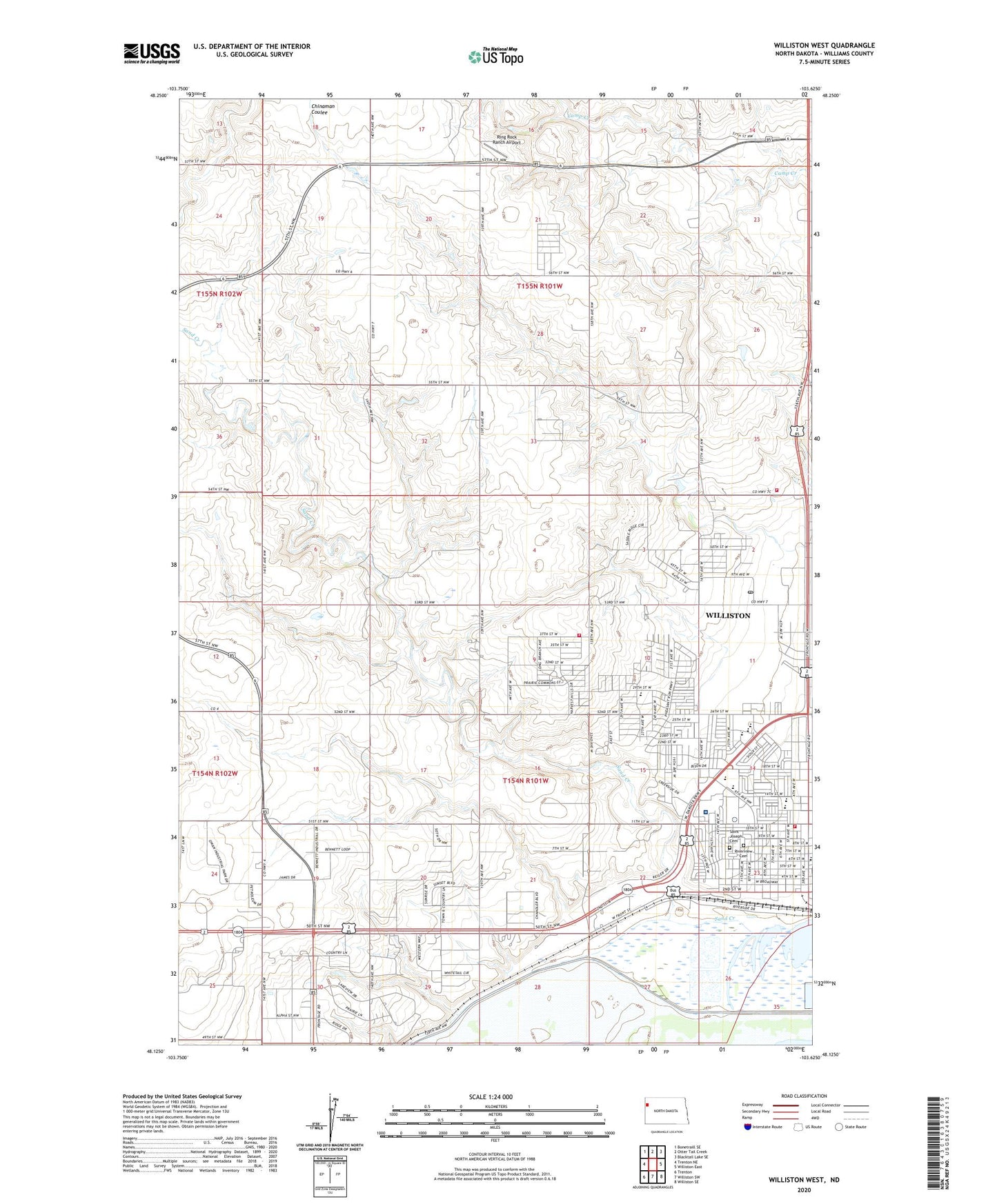
Williston West North Dakota US Topo Map
Couldn't load pickup availability
2024 topographic map quadrangle Williston West in the state of North Dakota. Scale: 1:24000. Based on the newly updated USGS 7.5' US Topo map series, this map is in the following counties: Williams. The map contains contour data, water features, and other items you are used to seeing on USGS maps, but also has updated roads and other features. This is the next generation of topographic maps. Printed on high-quality waterproof paper with UV fade-resistant inks.
Quads adjacent to this one:
West: Trenton NE
Northwest: Bonetraill SE
North: Otter Tail Creek
Northeast: Blacktail Lake SE
East: Williston East
Southeast: Williston SE
South: Williston SW
Southwest: Trenton
This map covers the same area as the classic USGS quad with code o48103b6.
Contains the following named places: Badlands Postal Store Post Office, Bethel Lutheran Nursing and Rehabilitation Center, CHI St Alexius Health Williston Medical Center, City of Williston, Del Easton Alternative High School, E J Hagen Aquatic Center, Hagan Elementary School, Lewis and Clark Elementary School, Ring Rock Ranch Airport, Riverview Cemetery, Saint Joseph Cemetery, Saint Josephs Elementary School, Sand Creek, Sloulin Field International Airport, Tandy Y School, Tone School, Township of Missouri Ridge, Township of Williston, Trinity Christian School, Webster School, Wilkinson Elementary School, Williston Community Library, Williston Fire Station, Williston High School, Williston Middle School