MyTopo
Upham North Dakota US Topo Map
Couldn't load pickup availability
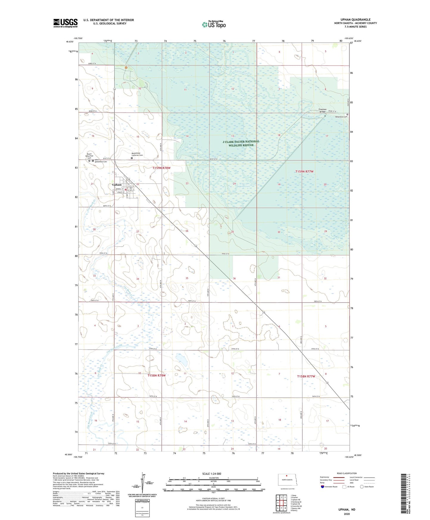
2024 topographic map quadrangle Upham in the state of North Dakota. Scale: 1:24000. Based on the newly updated USGS 7.5' US Topo map series, this map is in the following counties: McHenry. The map contains contour data, water features, and other items you are used to seeing on USGS maps, but also has updated roads and other features. This is the next generation of topographic maps. Printed on high-quality waterproof paper with UV fade-resistant inks.
Quads adjacent to this one:
West: Newburg SE
Northwest: Deep
North: Kramer
Northeast: Upham NE
East: Upham SE
Southeast: Bantry
South: Bantry NW
Southwest: Granville NE
This map covers the same area as the classic USGS quad with code o48100e6.
Contains the following named places: Bloomfield Lutheran Cemetery, City of Upham, Dam Number 320, Freeman Bridge, J Clark Salyer National Wildlife Refuge, J Clark Salyer Refuge Landing Field, Melankton Cemetery, Peace Reformed Cemetery, School Number 1, Township of Layton, Township of Meadow, Unit 320 Reservoir, Upham, Upham City Hall, Upham Post Office, Upham Rural Fire Station, West Melankton Cemetery