MyTopo
Venturia North Dakota US Topo Map
Couldn't load pickup availability
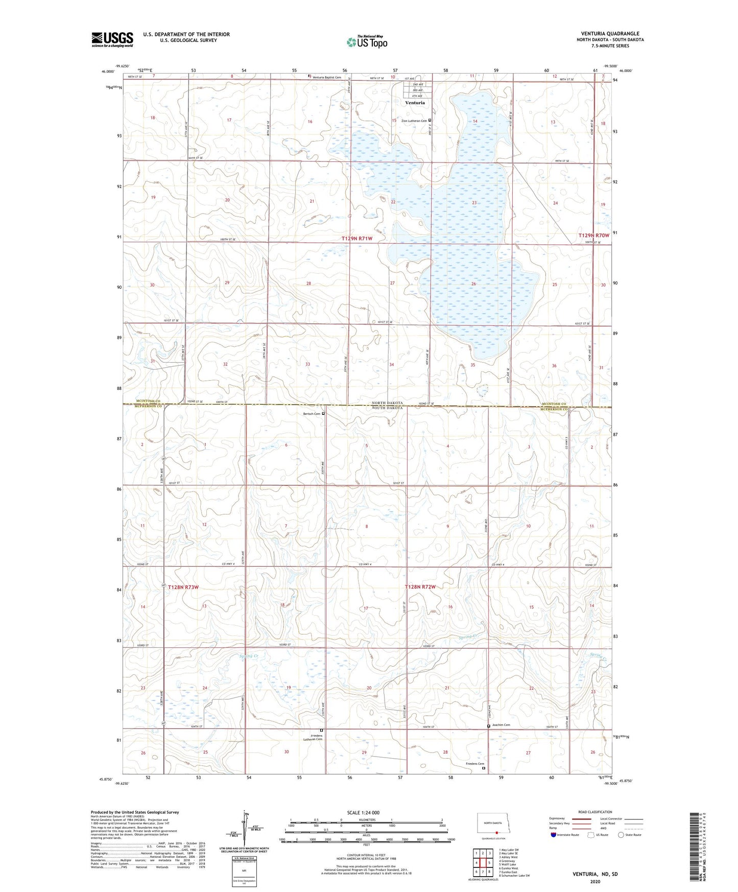
2024 topographic map quadrangle Venturia in the states of South Dakota, North Dakota. Scale: 1:24000. Based on the newly updated USGS 7.5' US Topo map series, this map is in the following counties: McIntosh, McPherson. The map contains contour data, water features, and other items you are used to seeing on USGS maps, but also has updated roads and other features. This is the next generation of topographic maps. Printed on high-quality waterproof paper with UV fade-resistant inks.
Quads adjacent to this one:
West: Greenway
Northwest: May Lake SW
North: May Lake SE
Northeast: Ashley West
East: Wolff Lake
Southeast: Schumacher Lake SW
South: Eureka East
Southwest: Eureka West
Contains the following named places: Bertsch Cemetery, City of Venturia, Friedens Cemetery, Friedens Lutheran Cemetery, Joachim Cemetery, Township of Detmold, Venturia, Venturia Baptist Cemetery, Zion Lutheran Cemetery