MyTopo
Eureka East South Dakota US Topo Map
Couldn't load pickup availability
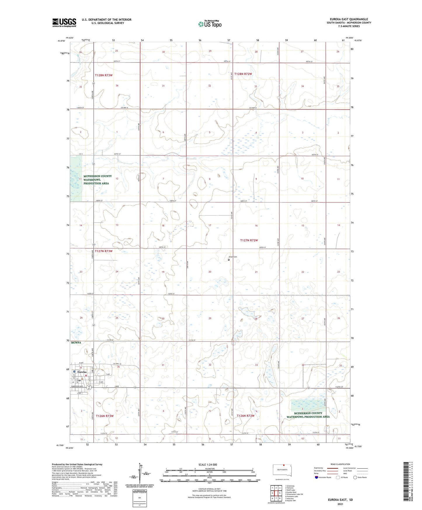
2021 topographic map quadrangle Eureka East in the state of South Dakota. Scale: 1:24000. Based on the newly updated USGS 7.5' US Topo map series, this map is in the following counties: McPherson. The map contains contour data, water features, and other items you are used to seeing on USGS maps, but also has updated roads and other features. This is the next generation of topographic maps. Printed on high-quality waterproof paper with UV fade-resistant inks.
Quads adjacent to this one:
West: Eureka West
Northwest: Greenway
Northeast: Wolff Lake
East: Schumacher Lake SW
Southeast: Hosmer NW
South: Hillsview
Southwest: Feinstein Lake
This map covers the same area as the classic USGS quad with code o45099g5.
Contains the following named places: Aman Cemetery, City of Eureka, Eureka, Eureka City Hall, Eureka City Police Station, Eureka Community Health Services Center Hospital, Eureka Elementary School, Eureka Fire Department, Eureka High School, Eureka Junior High School, Eureka Post Office, Kathryn Schulkoski Public Library, Myers Landing Field, Township of Rosenthal, Unorganized Territory of West McPherson, West McPherson EMS, ZIP Code: 57437