MyTopo
Aid Ohio US Topo Map
Couldn't load pickup availability
Also explore the Aid Forest Service Topo of this same quad for updated USFS data
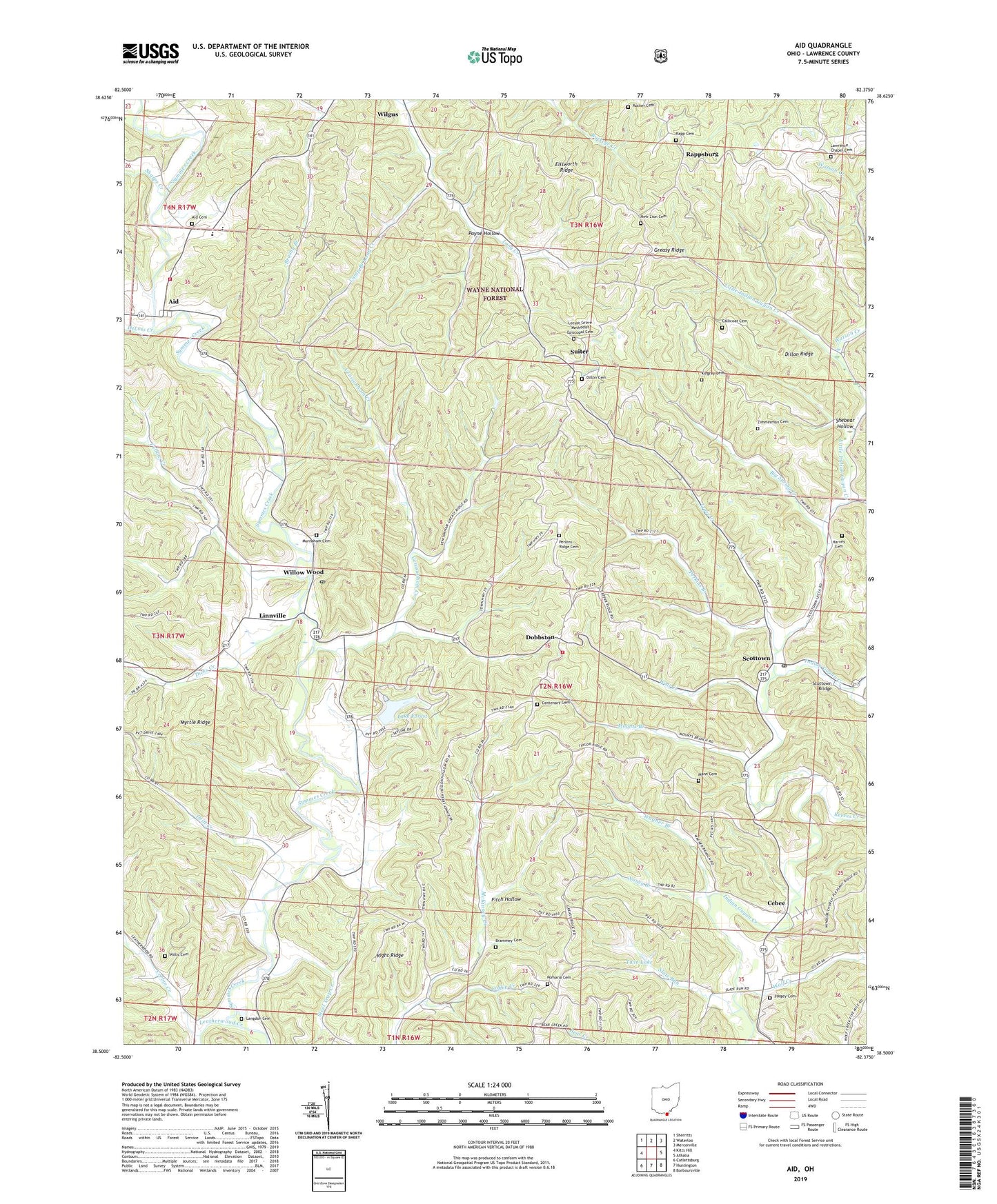
2023 topographic map quadrangle Aid in the state of Ohio. Scale: 1:24000. Based on the newly updated USGS 7.5' US Topo map series, this map is in the following counties: Lawrence. The map contains contour data, water features, and other items you are used to seeing on USGS maps, but also has updated roads and other features. This is the next generation of topographic maps. Printed on high-quality waterproof paper with UV fade-resistant inks.
Quads adjacent to this one:
West: Kitts Hill
Northwest: Sherritts
North: Waterloo
Northeast: Mercerville
East: Athalia
Southeast: Barboursville
South: Huntington
Southwest: Catlettsburg
This map covers the same area as the classic USGS quad with code o38082e4.
Contains the following named places: Aid, Aid Cemetery, Aid Post Office, Aid Township Volunteer Fire Department, Big Spring Creek, Brammey Cemetery, Callicoat Cemetery, Camp Branch Long Creek, Cebee, Cebee Post Office, Centenary Cemetery, Centenary Church, Coffee Creek, Corbin Creek, DeLoss Creek, Dicks Creek, Dillon Cemetery, Dillon Ridge, Dobbston, Dobbston Post Office, Drift Creek, Ellsworth Ridge, Fairview Church, Fitch Hollow, Forgey Cemetery, Gibson Chapel, Harvey Cemetery, Highway Church, Ida, Ida Post Office, Kingrey Cemetery, Lake Forest, Lake Forest Dam, Langdon Cemetery, Laurel Branch, Lawrence Chapel, Lawrence Chapel Cemetery, Leatherwood Creek, Linnville, Little Indian Guyan Creek, Locust Grove Church, Locust Grove Methodist Episcopal Cemetery, Mann Cemetery, Mason School, Mounts Branch, Murnaham Cemetery, Nancy Branch, New Zion Cemetery, New Zion Church, Payne Hollow, Perkins Branch, Perkins Ridge Cemetery, Point Pleasant Church, Pomaria Cemetery, Pomaria Church, Rapp Cemetery, Rappsburg, Rappsburg Post Office, Reeves Creek, Ridge Church, Right Ridge, Rucker Cemetery, Scottown, Scottown Bridge, Scottown Post Office, Sharps Creek, Shebear Hollow, Slate Run, Southeast Ohio Emergency Medical Services Station 15 Willow Wood, Steel Trap Creek, Suiter, Suiter Post Office, Symmes Creek Church, Symmes Valley Church, Symmes Valley High School, Symmes Valley Number 2 Elementary School, Township of Windsor, Township School Number 1, Trace Creek, Twin Lake, Venisonham Creek, Wagner Branch, Wall Creek, Watson Creek, Wilgus, Wilgus Post Office, Willis Cemetery, Willow Wood, Willow Wood Post Office, Windsor Chapel, Windsor Township Volunteer Fire Department, Wolf Creek, Yellow Creek, Zimmerman Cemetery, ZIP Codes: 45678, 45696