MyTopo
Antwerp Ohio US Topo Map
Couldn't load pickup availability
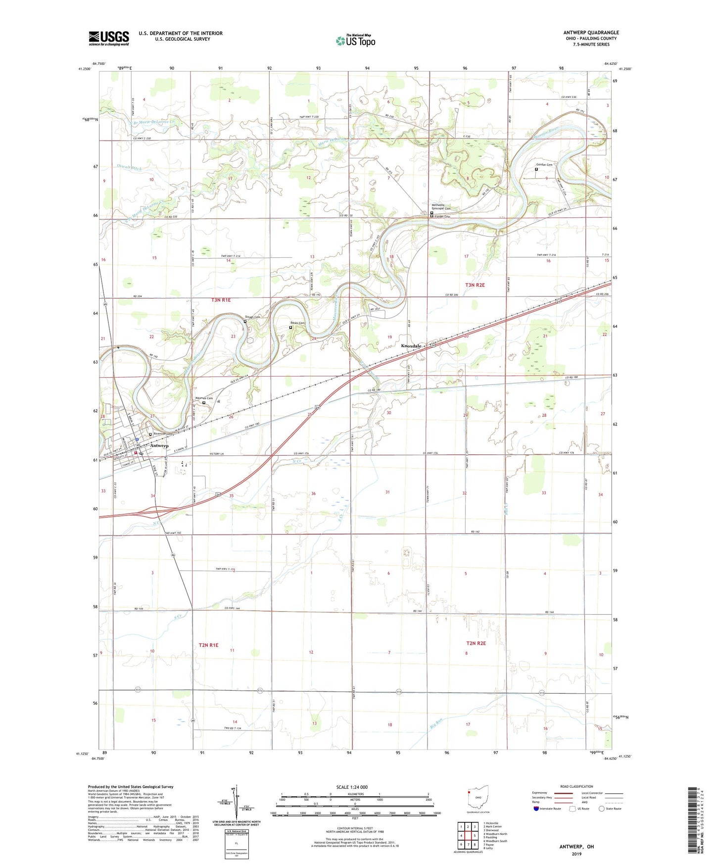
2019 topographic map quadrangle Antwerp in the state of Ohio. Scale: 1:24000. Based on the newly updated USGS 7.5' US Topo map series, this map is in the following counties: Paulding. The map contains contour data, water features, and other items you are used to seeing on USGS maps, but also has updated roads and other features. This is the next generation of topographic maps. Printed on high-quality waterproof paper with UV fade-resistant inks.
Quads adjacent to this one:
West: Woodburn North
Northwest: Hicksville
North: Mark Center
Northeast: Sherwood
East: Paulding
Southeast: Latty
South: Payne
Southwest: Woodburn South
Contains the following named places: Antwerp, Antwerp Branch Library, Antwerp Community Park, Antwerp Elementary School, Antwerp Emergency Medical Services, Antwerp Fire Department, Antwerp High School, Antwerp Police Department, Antwerp Post Office, Antwerp Town Hall, Antwerp United Methodist Church, Arena, Arena Post Office, Armstrong School, Banks Cemetery, Bethel Church, Carryall Township Hall, Chester School, Clark School, Columbia School, Curtis School, Elmtree School, Erter School, Fairview Grange Hall, First Presbyterian Church, Forder Cemetery, Forder School, Gerkins School, Gordon Cemetery, Knoxdale, Knoxdale Post Office, Marie DeLarme Creek, Maumee Cemetery, Methodist Episcopal Cemetery, North Branch Marie DeLarme Creek, North Creek, Oswalt Ditch, Pugh School, Riverbend Mobile Home Park, Riverside Cemetery, Riverside Park, Saint Marys Catholic Church, Schilderink Dairy, School Number 1, School Number 3, School Number 4, School Number 8, School Number 9, Slough Cemetery, South Branch Marie DeLarme Creek, South Creek, Stinger School, Sunnyside School, Township of Carryall, Township of Crane, Village of Antwerp, Zuber Cutoff, ZIP Code: 45813