MyTopo
Woodburn South Indiana US Topo Map
Couldn't load pickup availability
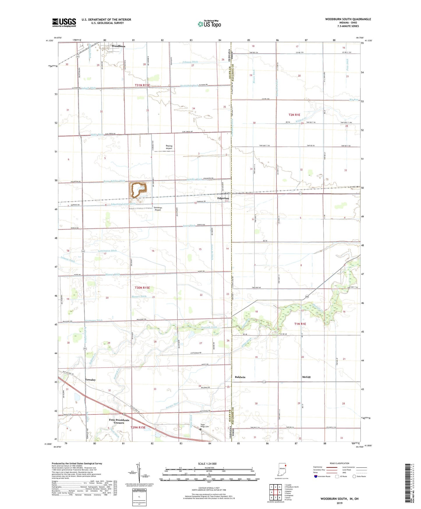
2022 topographic map quadrangle Woodburn South in the states of Indiana, Ohio. Scale: 1:24000. Based on the newly updated USGS 7.5' US Topo map series, this map is in the following counties: Allen, Paulding. The map contains contour data, water features, and other items you are used to seeing on USGS maps, but also has updated roads and other features. This is the next generation of topographic maps. Printed on high-quality waterproof paper with UV fade-resistant inks.
Quads adjacent to this one:
West: Maples
Northwest: Grabill
North: Woodburn North
Northeast: Antwerp
East: Payne
Southeast: Convoy
South: Dixon
Southwest: Hoagland
Contains the following named places: Anspaugh Ditch, Auer Ditch, Bainbridge School, Baldwin, Basting Airport, Bayer Ditch, Berthaud Ditch, Bethel Church, Bluejay School, Boyer School, Brady Airport, Brady Ditch, Brady School, Brown Ditch, Church of God Camp, Dickerson Ditch, Edgerton, Edgerton Quarry, Edgerton-Carson Ditch, Eibling Ditch, Foster Ditch, Four Presidents Corners, Gideon Ditch, Gromeaux Ditch, Henery Ditch, Hoffman Creek, Imbach Ditch, J Stabler Ditch, Johnson Ditch, Jones Branch Ditch, Jones Ditch, Knoblaugh Ditch, Lennington Ditch, Litzenberg Ditch, Lomont Ditch, Mansfield Ditch, McGill, McGill Post Office, Mercia Ditch, Midwest Quarry, Miller Ditch, Mooney Ditch, Mourey Ditch, Pleasant Grove School, Pleasant Valley Golf Course, Ray Ditch, Romy-Bobilya Ditch, Shilts Ditch, Shisler Ditch, Shugars Ditch, Smiley, Smiley Ditch, Smiley Post Office, Smiley School, Sorgen Ditch, Spangler Farm Airport, Spindler Ditch, Stabler Ditch, State Line Ditch, Steinman Airport, Sugar Ridge Cemetery, Swail Ditch, Townley, Township of Jackson, White Ditch, Wood Ditch, Woodchuck School, Wooding Ditch, Woods Ditch