MyTopo
Beaverdam Ohio US Topo Map
Couldn't load pickup availability
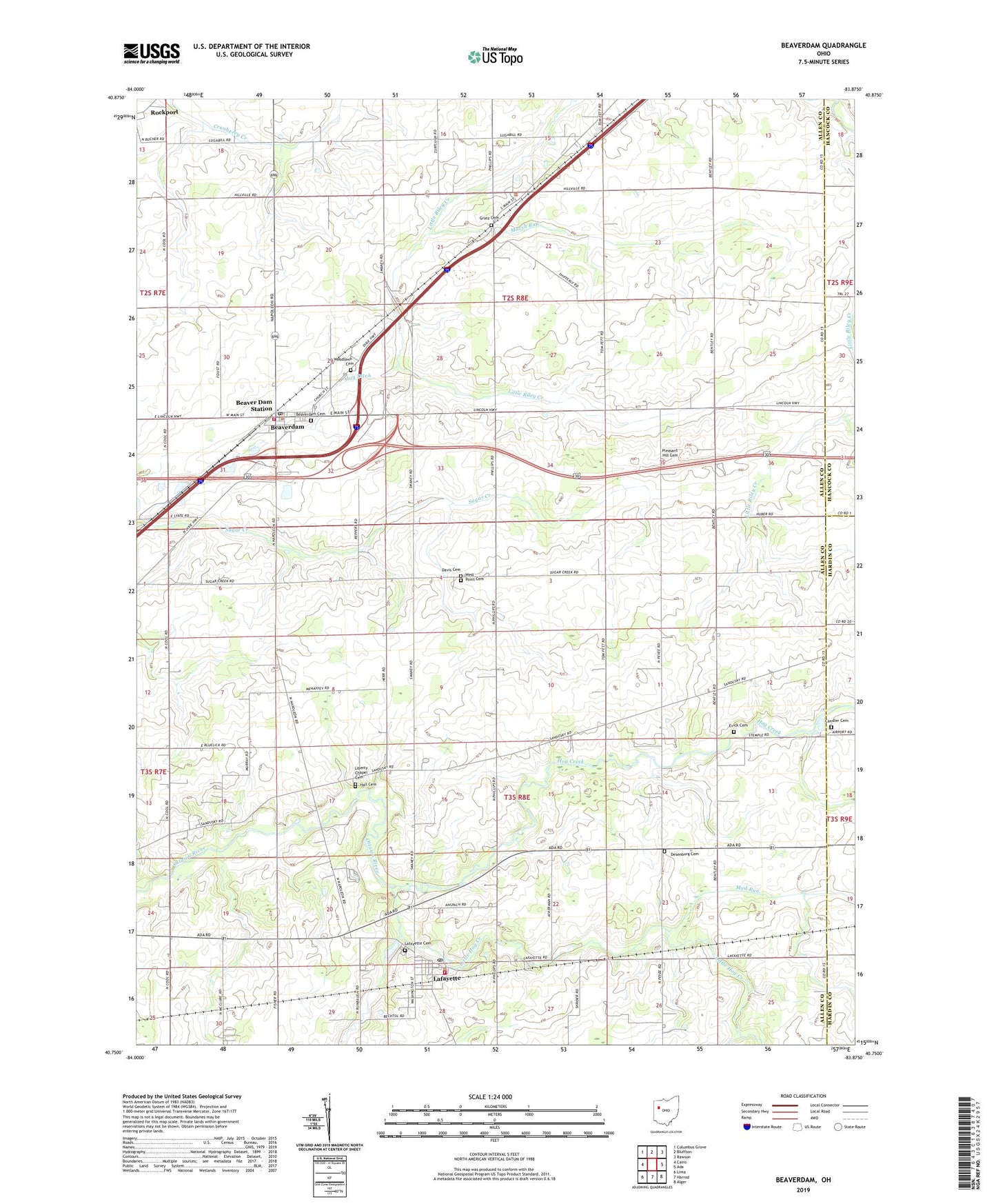
2019 topographic map quadrangle Beaverdam in the state of Ohio. Scale: 1:24000. Based on the newly updated USGS 7.5' US Topo map series, this map is in the following counties: Allen, Hardin, Hancock. The map contains contour data, water features, and other items you are used to seeing on USGS maps, but also has updated roads and other features. This is the next generation of topographic maps. Printed on high-quality waterproof paper with UV fade-resistant inks.
Quads adjacent to this one:
West: Cairo
Northwest: Columbus Grove
North: Bluffton
Northeast: Rawson
East: Ada
Southeast: Alger
South: Harrod
Southwest: Lima
Contains the following named places: Allen East High School, Allen East Primary School, Beaver Dam Station, Beaverdam, Beaverdam - Richland Fire Department, Beaverdam Cemetery, Beaverdam Post Office, Candler Cemetery, Cotner Ditch, County Line Church, Davis Cemetery, Desenberg School, Desenburg Cemetery, Emmanuel Church, Evick Cemetery, Gratz Cemetery, Hall Cemetery, Hog Creek, Huber Ditch, Huber School, Lafayette, Lafayette Cemetery, Lafayette Jackson Township Fire Department, Lafayette Post Office, Liberty Chapel, Liberty Chapel Cemetery, Little Hog Creek, Marsh Run, May Ditch, Mud Run, Pleasant Hill Cemetery, Pleasant Hill Church, Stratton Greenhouses, Township of Jackson, Township of Richland, Village of Beaverdam, Village of Lafayette, West Point Cemetery, Woodland Cemetery, ZIP Codes: 45808, 45854