MyTopo
Rawson Ohio US Topo Map
Couldn't load pickup availability
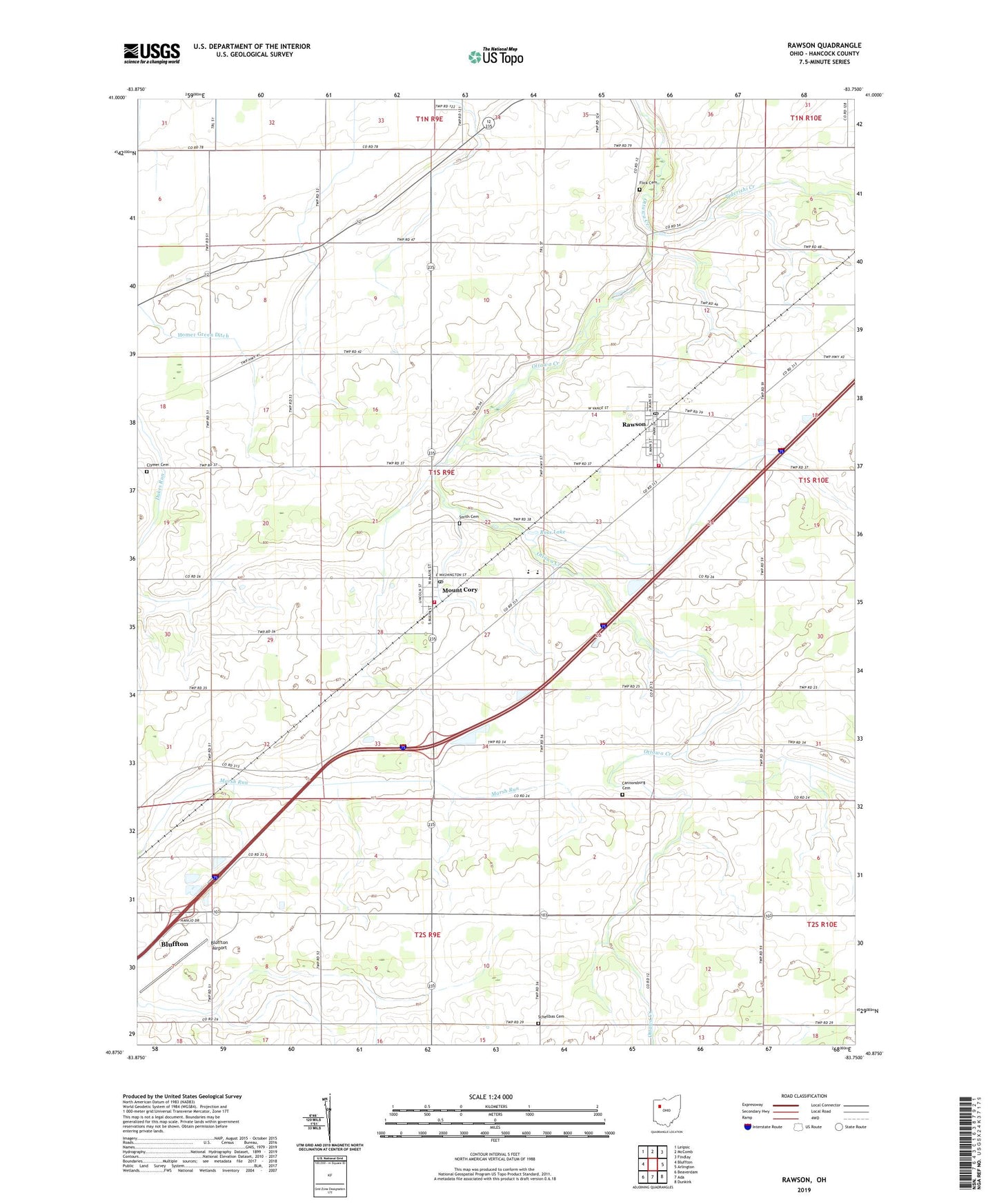
2023 topographic map quadrangle Rawson in the state of Ohio. Scale: 1:24000. Based on the newly updated USGS 7.5' US Topo map series, this map is in the following counties: Hancock. The map contains contour data, water features, and other items you are used to seeing on USGS maps, but also has updated roads and other features. This is the next generation of topographic maps. Printed on high-quality waterproof paper with UV fade-resistant inks.
Quads adjacent to this one:
West: Bluffton
Northwest: Leipsic
North: McComb
Northeast: Findlay
East: Arlington
Southeast: Dunkirk
South: Ada
Southwest: Beaverdam
This map covers the same area as the classic USGS quad with code o40083h7.
Contains the following named places: Augustine Farms, Bethesda Church, Bluffton Airport, Cannonsburg, Cannonsburg Cemetery, Clymer Cemetery, Cordelia, Cordelia Post Office, Cory-Rawson Elementary School, Cory-Rawson High School, Cory-Rawson Middle School, Flick Cemetery, Gorsuch Farm, Homer Green Ditch, Jod Bark Farm, K and J Farm, Mount Cory, Mount Cory Post Office, Pleasant View Church, Pure Country Greenhouses, Rawson, Rawson Post Office, Ross Lake, Schellbas Cemetery, Smith Cemetery, Tiderishi Creek, Township of Union, Union Township Mount Cory Volunteer Fire Department, Union Township Rawson Fire Department, Village of Mount Cory, Village of Rawson, ZIP Codes: 45868, 45881