MyTopo
Harrod Ohio US Topo Map
Couldn't load pickup availability
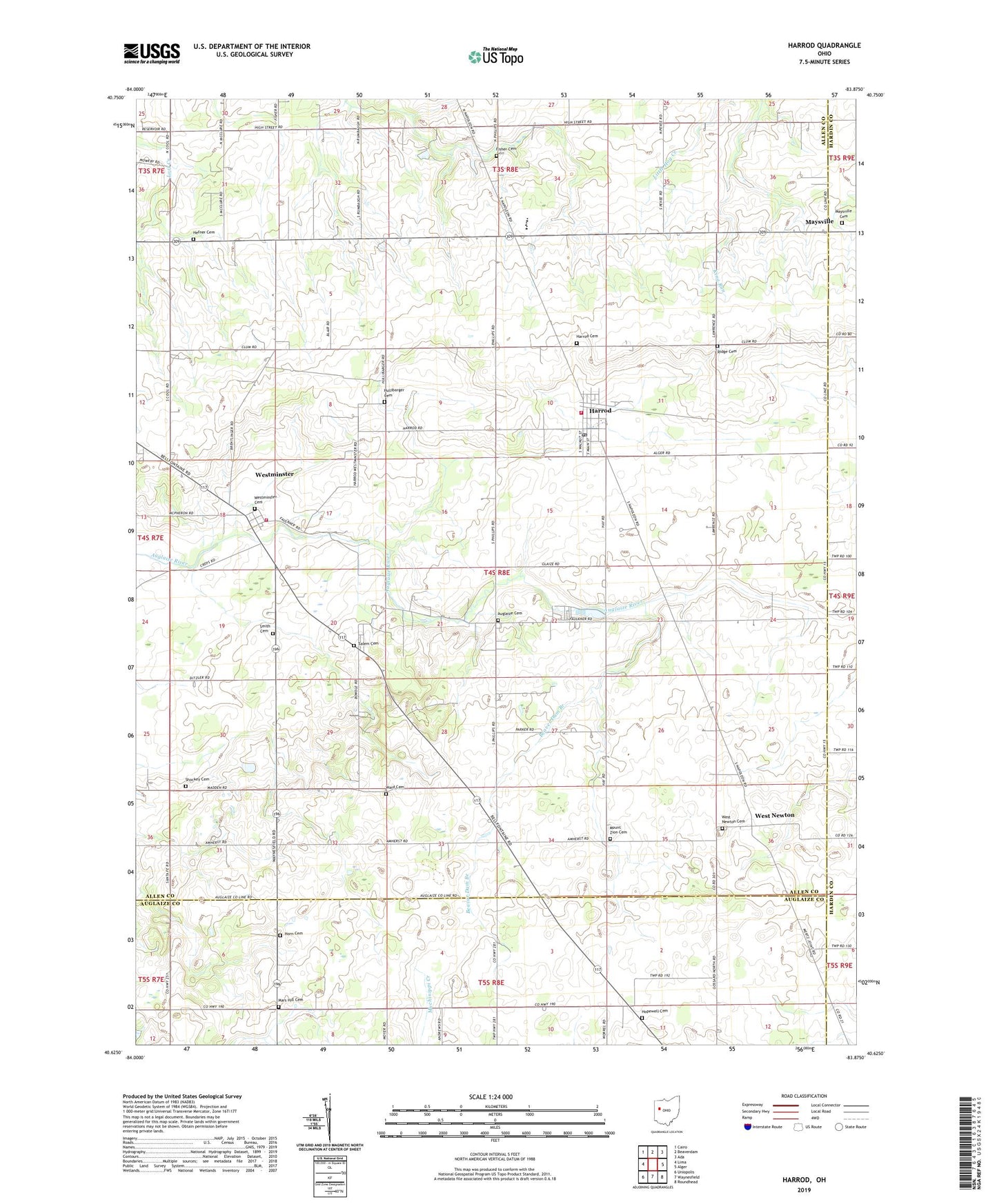
2023 topographic map quadrangle Harrod in the state of Ohio. Scale: 1:24000. Based on the newly updated USGS 7.5' US Topo map series, this map is in the following counties: Allen, Auglaize, Hardin. The map contains contour data, water features, and other items you are used to seeing on USGS maps, but also has updated roads and other features. This is the next generation of topographic maps. Printed on high-quality waterproof paper with UV fade-resistant inks.
Quads adjacent to this one:
West: Lima
Northwest: Cairo
North: Beaverdam
Northeast: Ada
East: Alger
Southeast: Roundhead
South: Waynesfield
Southwest: Uniopolis
This map covers the same area as the classic USGS quad with code o40083f8.
Contains the following named places: Allen East Elementary School, Auglaize Cemetery, Auglaize Church, Auglaize School, Baker School, Beaver Dam Branch, Beaverdam School, Billtown School, Blair School, Fisher Cemetery, Fisher School, Gossard School, Harrod, Harrod Cemetery, Harrod Post Office, Harrod Volunteer Fire and Rescue, Hefner Cemetery, Heidelberg Church, High Street Church, Hiptight School, Hopewell Cemetery, Hopewell Church, Horn Cemetery, Hullibarger Cemetery, Ice School, King Run, Mars Hill Cemetery, Maysville, Maysville Cemetery, Morris School, Mount Zion Cemetery, Mount Zion Church, Ridge Cemetery, Ridge School, Salem Cemetery, Shockey Cemetery, Smith Cemetery, Sugartree School, Township of Auglaize, Village of Harrod, Ward Cemetery, West Newton, West Newton Cemetery, West Newton Post Office, Westminster, Westminster Cemetery, Westminster Census Designated Place, Westminster Post Office, Westminster Rural Fire Department, ZIP Code: 45850