MyTopo
Alger Ohio US Topo Map
Couldn't load pickup availability
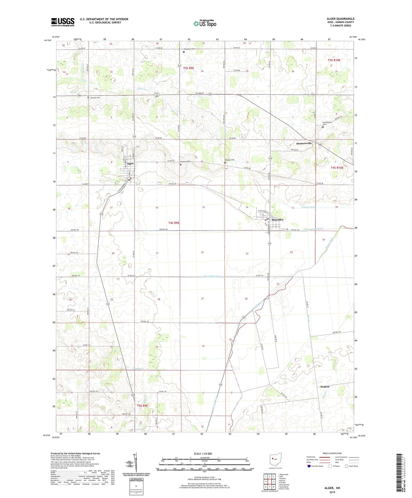
2023 topographic map quadrangle Alger in the state of Ohio. Scale: 1:24000. Based on the newly updated USGS 7.5' US Topo map series, this map is in the following counties: Hardin. The map contains contour data, water features, and other items you are used to seeing on USGS maps, but also has updated roads and other features. This is the next generation of topographic maps. Printed on high-quality waterproof paper with UV fade-resistant inks.
Quads adjacent to this one:
West: Harrod
Northwest: Beaverdam
North: Ada
Northeast: Dunkirk
East: Foraker
Southeast: Silver Creek
South: Roundhead
Southwest: Waynesfield
This map covers the same area as the classic USGS quad with code o40083f7.
Contains the following named places: Alger, Alger Community Fire Association, Alger Elementary School, Alger Post Office, Amherst Greenhouse, Belmont Court, Carman Cemetery, College School, Cooney Ditch, Cottonwood Ditch, Dunlap Creek, Elder Creek, Elder Creek School, Eureka School, Flat Branch, Huntersville, Huntersville Cemetery, Huntersville Post Office, Kingsley School, Klinger School, Lone Oak School, McGuffey, McGuffey Post Office, McGuffey Volunteer Fire Company, Mustard School, Pleasant Valley School, Preston Cemetery, Quickstep, Quickstep Pentecostal Church of God, Rice School, Rising Sun School, Scioto Marsh, Shadley Cemetery, Shadyvale School, Thompson School, Township of Marion, Twin Branches, Upper Scioto Valley Ambulance District Alger Station, Upper Scioto Valley Ambulance District McGuffey Station, Upper Scioto Valley High School, Village of Alger, Village of McGuffey, Walton, Woodlawn Cemetery, Woodlawn School, ZIP Codes: 45812, 45859