MyTopo
Brighton Ohio US Topo Map
Couldn't load pickup availability
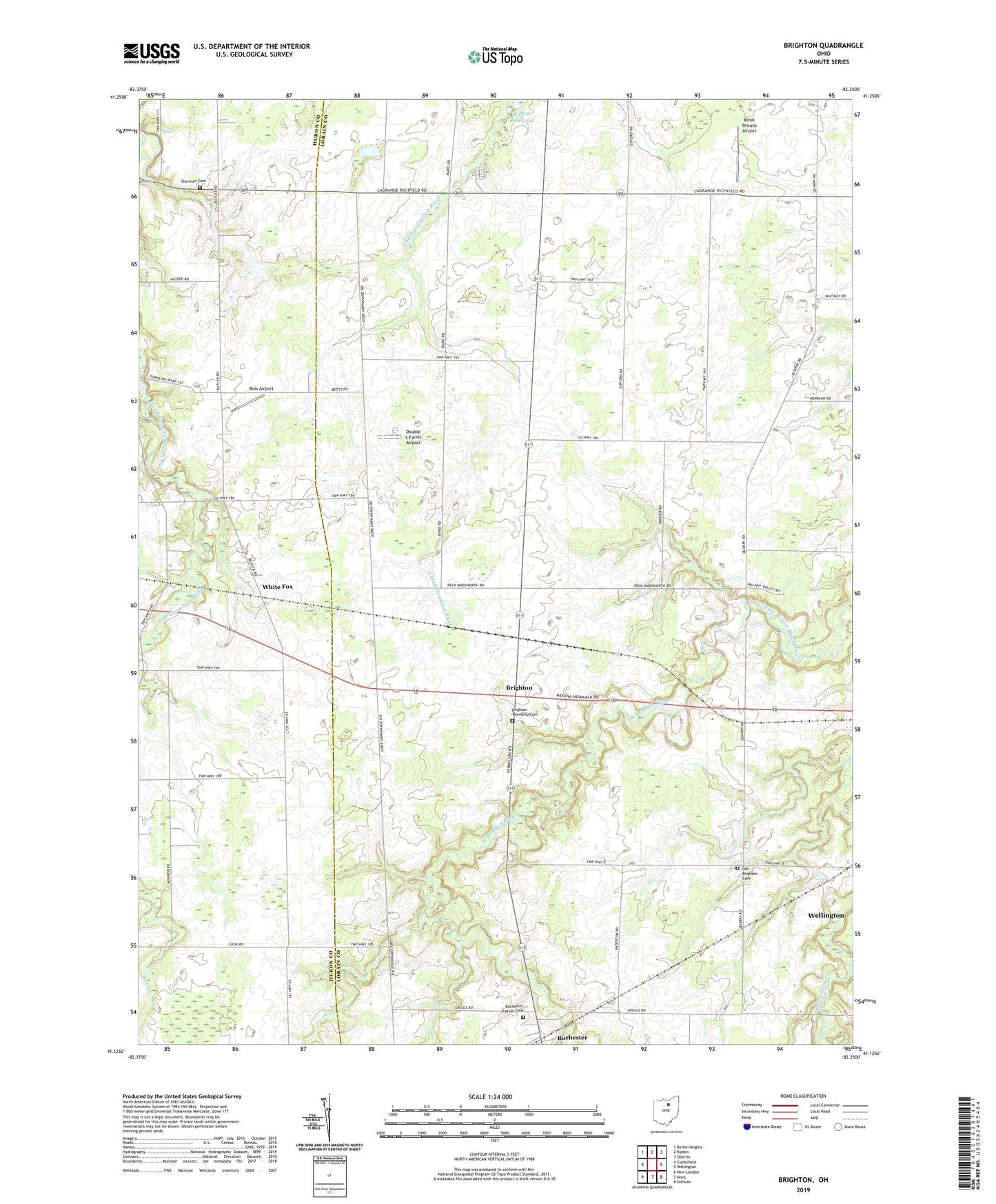
2019 topographic map quadrangle Brighton in the state of Ohio. Scale: 1:24000. Based on the newly updated USGS 7.5' US Topo map series, this map is in the following counties: Lorain, Huron. The map contains contour data, water features, and other items you are used to seeing on USGS maps, but also has updated roads and other features. This is the next generation of topographic maps. Printed on high-quality waterproof paper with UV fade-resistant inks.
Quads adjacent to this one:
West: Clarksfield
Northwest: Berlin Heights
North: Kipton
Northeast: Oberlin
East: Wellington
Southeast: Sullivan
South: Nova
Southwest: New London
Contains the following named places: Brighton, Brighton Congregational Church, Brighton Post Office, Brighton Township Cemetery, Brighton Township Hall, Brighton United Methodist Church, Camden, Double S Farms Airport, East Creek, Echo Valley Golf Course, Engelhardt Farms, Janes School, Kipton Reservoir, Kosik Airport, Old Brighton Cemetery, Rochester, Rochester Post Office, Rochester Station Cemetery, Rochester Township Hall, Ross Airport, Rowland School, Sherman Cemetery, Thomas School, Todd School, Township of Brighton, Township of Camden, White Fox, Whitefox Post Office, Ziegler School