MyTopo
Sullivan Ohio US Topo Map
Couldn't load pickup availability
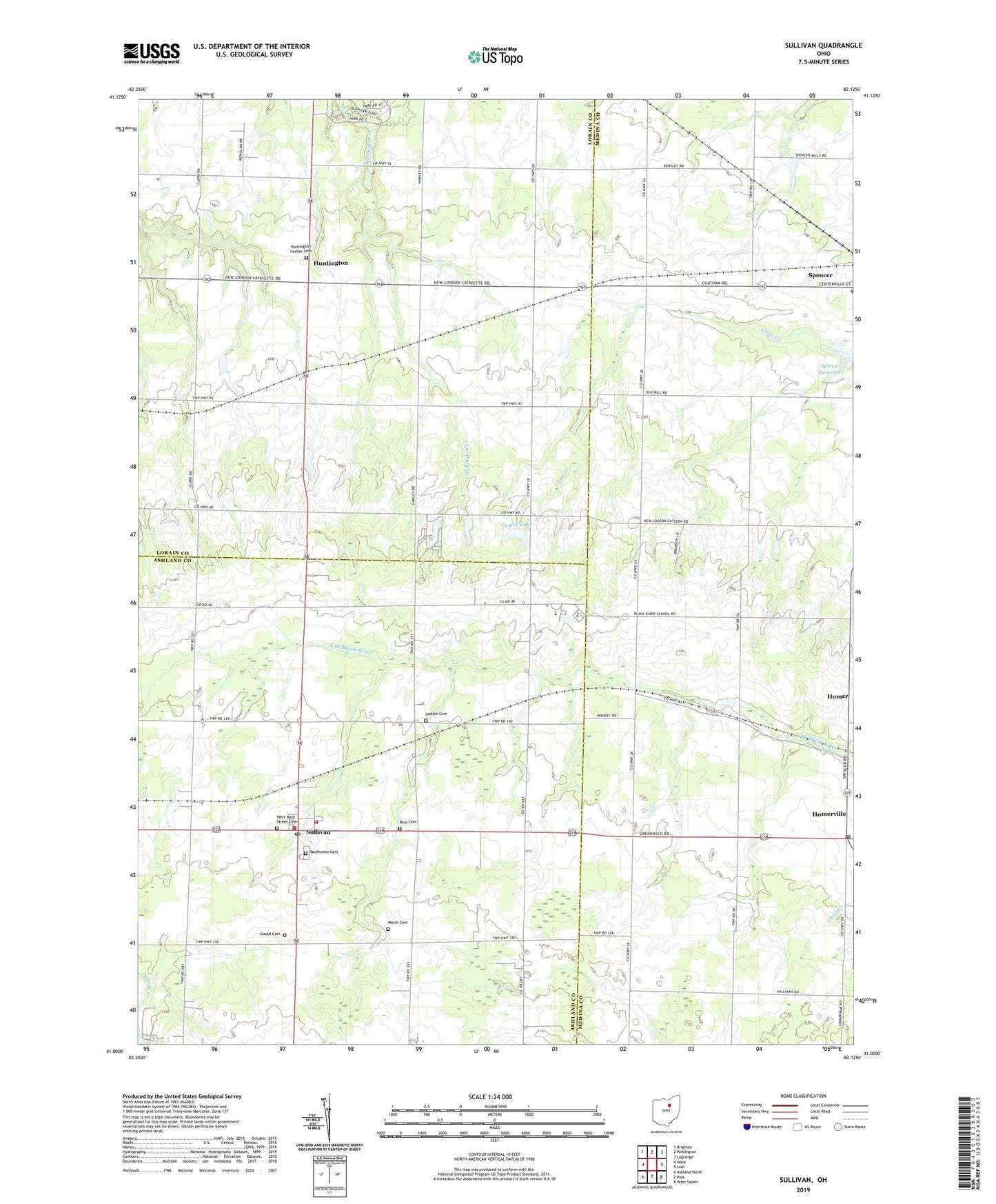
2023 topographic map quadrangle Sullivan in the state of Ohio. Scale: 1:24000. Based on the newly updated USGS 7.5' US Topo map series, this map is in the following counties: Lorain, Medina, Ashland. The map contains contour data, water features, and other items you are used to seeing on USGS maps, but also has updated roads and other features. This is the next generation of topographic maps. Printed on high-quality waterproof paper with UV fade-resistant inks.
Quads adjacent to this one:
West: Nova
Northwest: Brighton
North: Wellington
Northeast: Lagrange
East: Lodi
Southeast: West Salem
South: Polk
Southwest: Ashland North
This map covers the same area as the classic USGS quad with code o41082a2.
Contains the following named places: Black River High School, Black River Intermediate School, Black River Middle School, Black River Primary School, Centerville, Gould Cemetery, Homer, Homerville, Homerville Post Office, Hubler Cemetery, Huntington, Huntington Center Cemetery, Huntington Post Office, Huntington Public School, Huntington Station, Huntington Township Hall, Loretta Lake, Loretta Lake Dam, Marsh Cemetery, Newtons, Rice Cemetery, Rustic Lake, Rustic Lake Dam, Southview Cemetery, Spencer Reservoir, Sullivan, Sullivan Census Designated Place, Sullivan Post Office, Sullivan Volunteer Fire Department, Sullivan Volunteer Fire Department Station 2, Taylor Lake, Taylor Lake Dam, Township of Homer, Township of Huntington, Township of Sullivan, United Church, West Homer Church, West Main Street Cemetery, ZIP Code: 44880