MyTopo
Nova Ohio US Topo Map
Couldn't load pickup availability
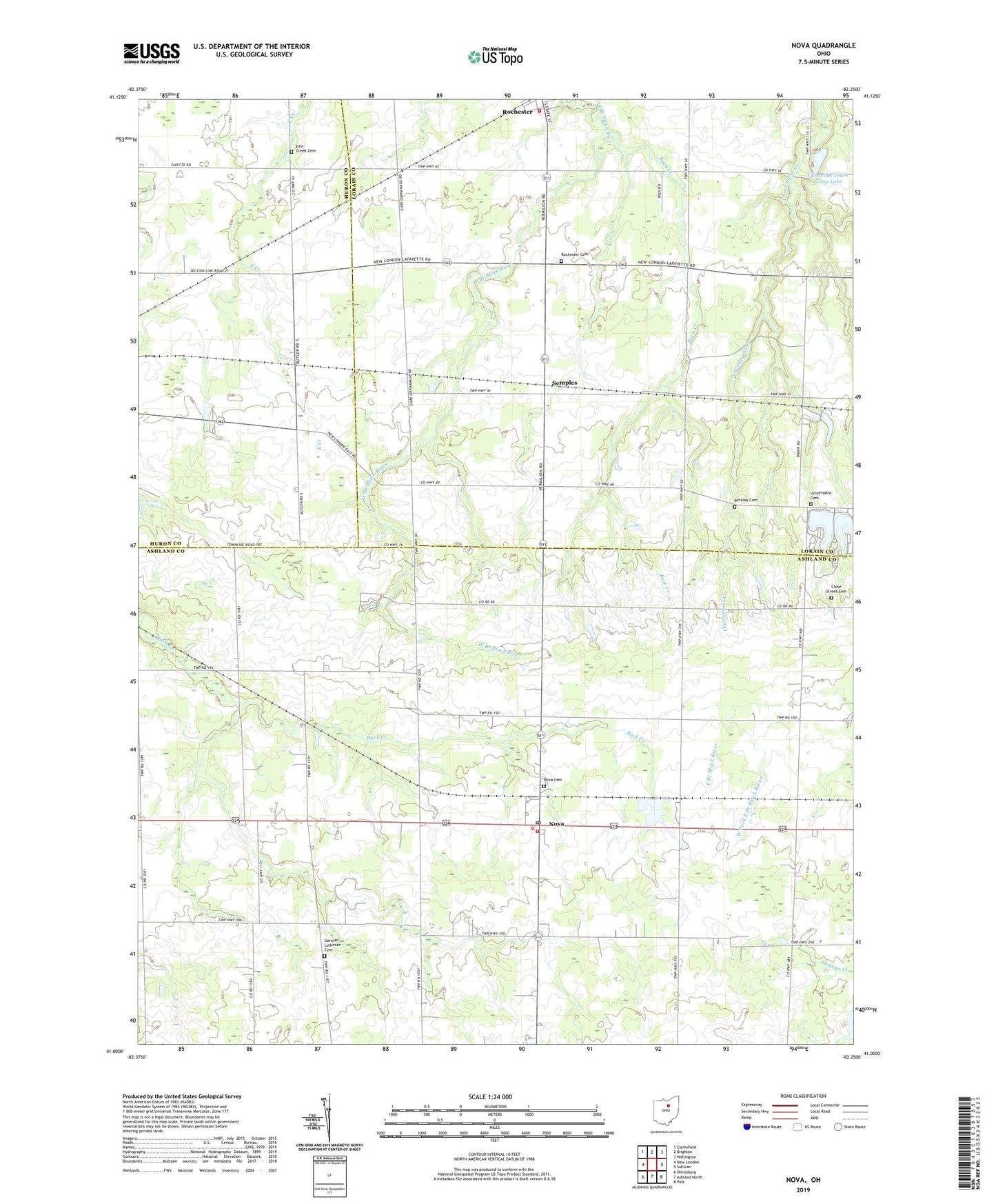
2023 topographic map quadrangle Nova in the state of Ohio. Scale: 1:24000. Based on the newly updated USGS 7.5' US Topo map series, this map is in the following counties: Ashland, Lorain, Huron. The map contains contour data, water features, and other items you are used to seeing on USGS maps, but also has updated roads and other features. This is the next generation of topographic maps. Printed on high-quality waterproof paper with UV fade-resistant inks.
Quads adjacent to this one:
West: New London
Northwest: Clarksfield
North: Brighton
Northeast: Wellington
East: Sullivan
Southeast: Polk
South: Ashland North
Southwest: Olivesburg
This map covers the same area as the classic USGS quad with code o41082a3.
Contains the following named places: Avon Maple Farm, Bakers Crossing, Beckley Cemetery, Ber Al. Lake, Buck Creek, Buckley School, Clare Mar Camp Lake, Clare Mar Camp Lake Dam, Close Street Cemetery, Dirlams Store, East Creek Cemetery, Fay School, Galloway Farms, German Lutheran Cemetery, Lake Ber Al Dam, Nova, Nova Cemetery, Nova Pond, Nova Pond Dam, Nova Post Office, Rochester Cemetery, Rochester Volunteer Fire Department, Rohrs Lake, Rohrs Lake Dam, Rolling Acres Golf Course, Ruggles - Troy Volunteer Fire Department, Semples, Terrace Lake Park, Township of Rochester, Township of Troy, Ukranian Youth Camp Lake, Ukranian Youth Camp Lake Dam, Universalist Cemetery, Village of Rochester, ZIP Code: 44859