MyTopo
Caledonia Ohio US Topo Map
Couldn't load pickup availability
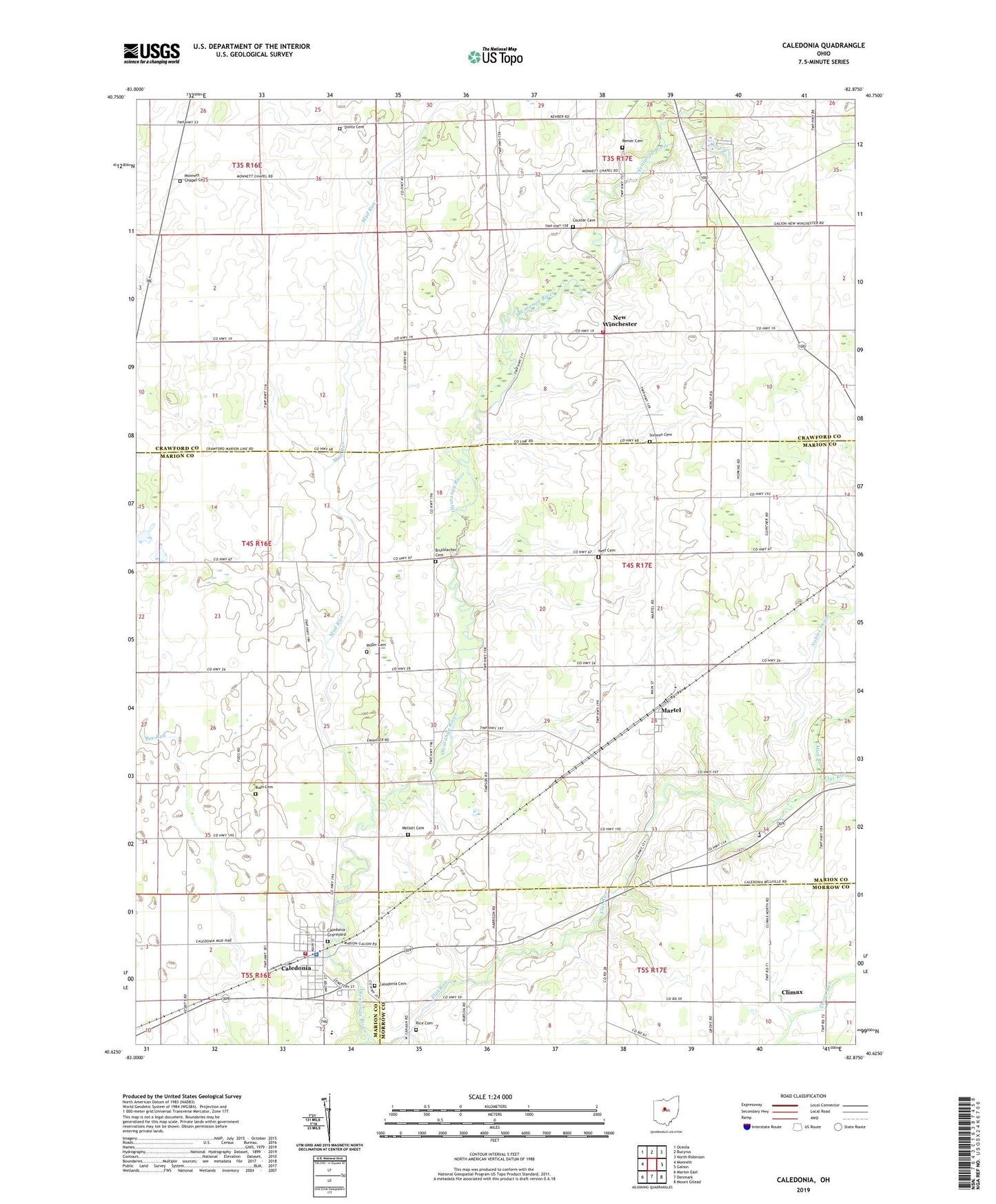
2023 topographic map quadrangle Caledonia in the state of Ohio. Scale: 1:24000. Based on the newly updated USGS 7.5' US Topo map series, this map is in the following counties: Marion, Crawford, Morrow. The map contains contour data, water features, and other items you are used to seeing on USGS maps, but also has updated roads and other features. This is the next generation of topographic maps. Printed on high-quality waterproof paper with UV fade-resistant inks.
Quads adjacent to this one:
West: Monnett
Northwest: Oceola
North: Bucyrus
Northeast: North Robinson
East: Galion
Southeast: Mount Gilead
South: Denmark
Southwest: Marion East
This map covers the same area as the classic USGS quad with code o40082f8.
Contains the following named places: Albright School, Brucklacher Cemetery, Bunker Hill School, Caledonia, Caledonia Cemetery, Caledonia Elementary School, Caledonia Graveyard, Caledonia Memorial United Methodist Church, Caledonia Police Department, Caledonia Post Office, Church of Christ in Caledonia, Climax, Climx Post Office, Clyde Church, Cohan School, Coulter Cemetery, Craner School, Douce School, First Consolidated Fire District Station, Flat Run, Hipscher School, Hog Swamp School, Huntly School, Lee School, Maple Grove School, Martel, Martel United Methodist Church, Mellott Cemetery, Miller Cemetery, Monnett Chapel, Monnett Chapel Cemetery, Mud Run, Neff Cemetery, New Winchester, New Winchester Golf Course, New Winchester Post Office, Noblet Drain, North Canaan School, Remer Cemetery, Rice Cemetery, Rush Cemetery, Saint Johns Church, School Number 8, Sixteen Cemetery, Sixteen Church, Sixteen School, Stoltz Cemetery, Stringtown, Stringtown School, Sugar Grove Lake, Sugar Grove Lake Dam, Thorn Run, Township of Tully, Village of Caledonia, Whetstone Elementary School, Whetstone Township Fire Department Station 1, ZIP Code: 43314