MyTopo
Carroll Ohio US Topo Map
Couldn't load pickup availability
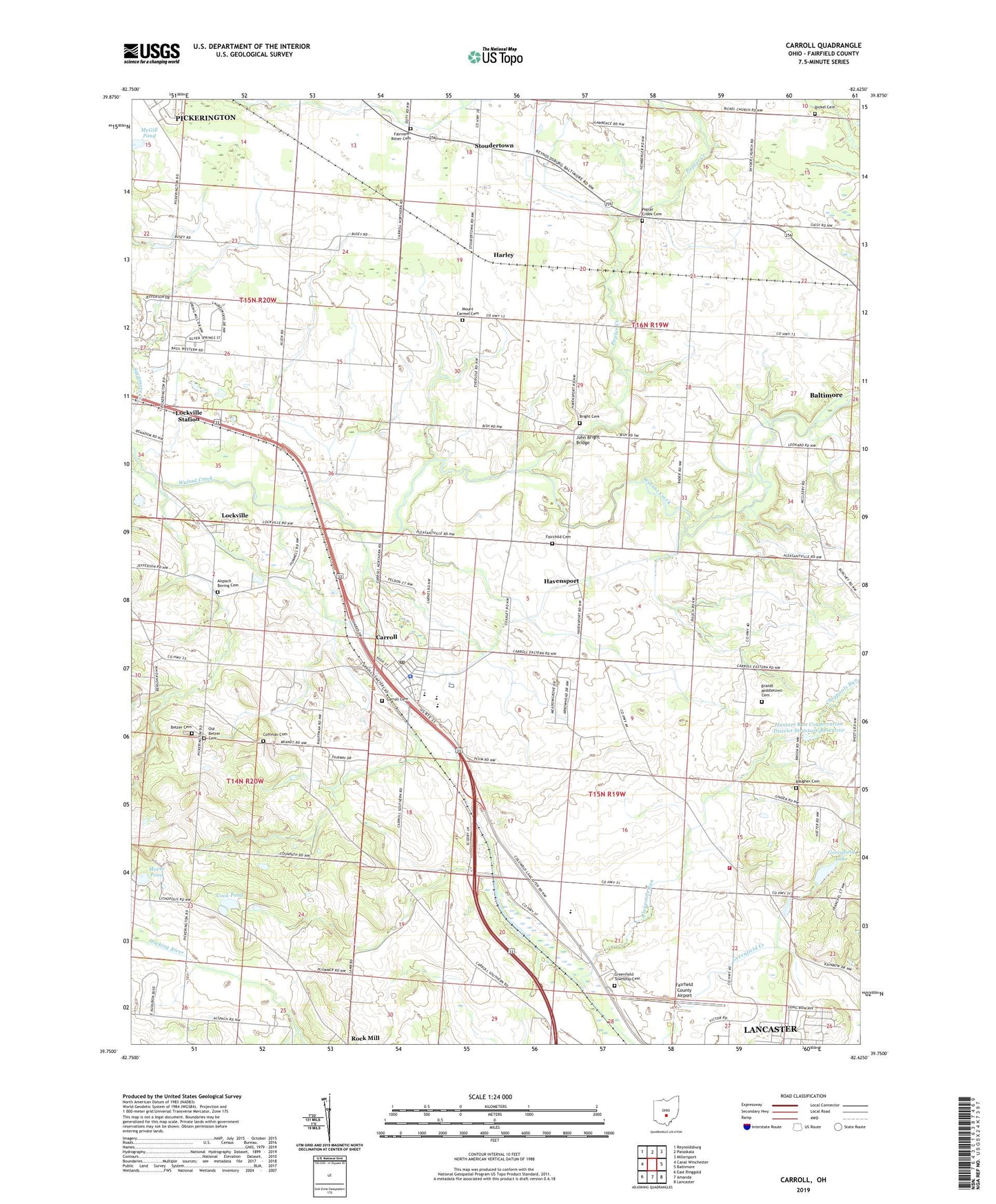
2019 topographic map quadrangle Carroll in the state of Ohio. Scale: 1:24000. Based on the newly updated USGS 7.5' US Topo map series, this map is in the following counties: Fairfield. The map contains contour data, water features, and other items you are used to seeing on USGS maps, but also has updated roads and other features. This is the next generation of topographic maps. Printed on high-quality waterproof paper with UV fade-resistant inks.
Quads adjacent to this one:
West: Canal Winchester
Northwest: Reynoldsburg
North: Pataskala
Northeast: Millersport
East: Baltimore
Southeast: Lancaster
South: Amanda
Southwest: East Ringgold
Contains the following named places: Alspach Boving Cemetery, Anderson Airport, Baugher Cemetery, Betzer Cemetery, Bickel Cemetery, Bismark Park, Bloom - Carroll High School, Boyer Cemetery, Brandt Middletown Cemetery, Bright Cemetery, Carroll, Carroll Cemetery, Carroll Elementary School, Carroll Municipal Building, Carroll Police Department, Carroll Post Office, Claypools Run, Coffman Cemetery, Cook Pond, Cook Pond Dam, Fairchild Cemetery, Fairfield County, Fairfield County Airport, Fairview Church, Fairview-Ritter Cemetery, Greenfield Dam Wildlife Area, Greenfield Lake, Greenfield Lake Dam, Greenfield Township Cemetery, Greenfield Township Fire Department Station 560, Harley, Havensport, Honey Hill Orchard, Hunters Run Conservation District Structure Five Dam, Hunters Run Conservation District Structure Reservoir, Hunters Run Conservation District Structure Six Dam, Jefferson Woods, John Bright Bridge, Lockville, Lockville Park, Lockville Post Office, Lockville Station, McGill Pond, McGill Pond Dam, Morse Pond, Morse Pond Dam, Mount Carmel Cemetery, Mount Carmel Church, Ohio Power Company Pond Mur-32, Ohio Power Company Pond Mur-32 Dam, Old Betzer Cemetery, Pine Hill Golf Course, Poplar Creek, Poplar Creek Cemetery, Ritter School, River of Life Church, Saint Michaels Church, Stoudertown, Sunny Hill Fruit Farm, Township of Greenfield, Township of Liberty, Village of Carroll, Wildermuth Memorial Church, ZIP Code: 43112