MyTopo
Millersport Ohio US Topo Map
Couldn't load pickup availability
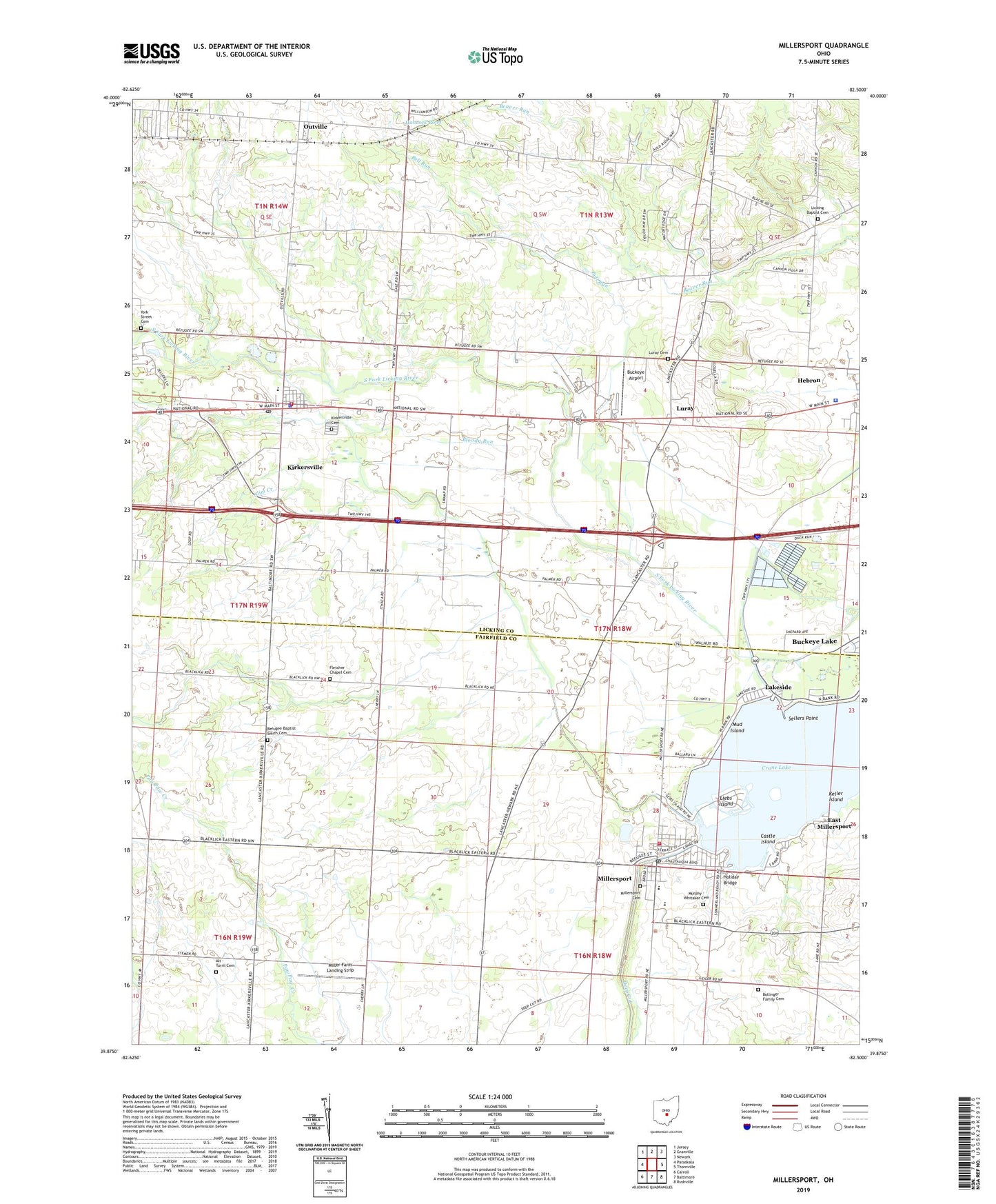
2023 topographic map quadrangle Millersport in the state of Ohio. Scale: 1:24000. Based on the newly updated USGS 7.5' US Topo map series, this map is in the following counties: Licking, Fairfield. The map contains contour data, water features, and other items you are used to seeing on USGS maps, but also has updated roads and other features. This is the next generation of topographic maps. Printed on high-quality waterproof paper with UV fade-resistant inks.
Quads adjacent to this one:
West: Pataskala
Northwest: Jersey
North: Granville
Northeast: Newark
East: Thornville
Southeast: Rushville
South: Baltimore
Southwest: Carroll
This map covers the same area as the classic USGS quad with code o39082h5.
Contains the following named places: Alt - Turril Cemetery, Bell Run, Bloody Run, Bloody Run Swamp, Bollinger Family Cemetery, Buckeye Airport, Buckeye Lake, Canyon Villa Estates, Castle Island, Columbus Municipal Building, Deep Cut, Deweese Ponds, Dolder's Nursery, East Millersport, Fletcher Chapel Cemetery, Fletcher Chapel Methodist Church, Hancock Pond, Happy Homes, Harrison Township House, Har-Win Acres, Hebron Police Department, Hebron State Fish Hatchery, Hickory Island, Holiday Bridge, Hollywood by the Lake, Keller Island, Kirkersville, Kirkersville Cemetery, Kirkersville Elementary School, Kirkersville Police Department, Kirkersville Post Office, Kirkersville United Methodist Church, Lakeside, Licking Baptist Cemetery, Licking Church, Liebs Island, Luray, Luray Cemetery, Luray Christian Apostolic Church, Luray Post Office, M P W Heliport, Miller Farm Landing Strip, Millersport, Millersport Cemetery, Millersport Elementary School, Millersport Fire Department Station 630, Millersport High School, Millersport Post Office, Monticello, Monticello Post Office, Mud Island, Murphy - Whitaker Cemetery, National Trail Raceway, O'Kunes Mill, Outville, Outville Presbyterian Church, Pinecrest Estates, Refugee Baptist Smith Cemetery, Sandstone Canyon, Sellers Point, Shaler Mill, Slim Creek, Summerland Beach, Sunshine Park, Township of Harrison, Township of Union, Trinity Lutheran Church, Village of Kirkersville, Village of Millersport, West Licking Joint Fire District Station 2, WNKO-FM (Newark), Wooded Hills, York Street Cemetery, ZIP Codes: 43025, 43033, 43046