MyTopo
Chester Ohio US Topo Map
Couldn't load pickup availability
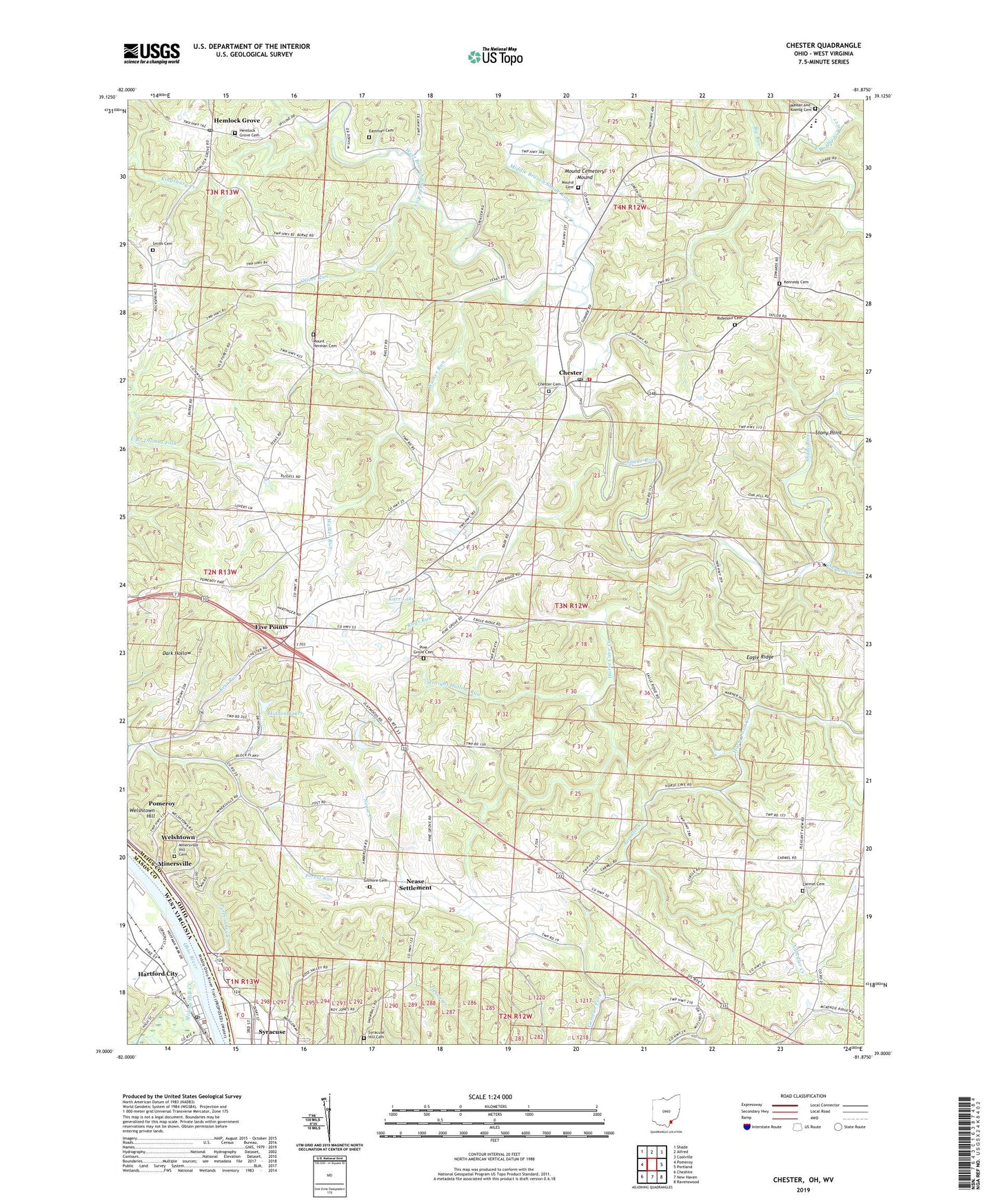
2023 topographic map quadrangle Chester in the states of Ohio, West Virginia. Scale: 1:24000. Based on the newly updated USGS 7.5' US Topo map series, this map is in the following counties: Meigs, Mason. The map contains contour data, water features, and other items you are used to seeing on USGS maps, but also has updated roads and other features. This is the next generation of topographic maps. Printed on high-quality waterproof paper with UV fade-resistant inks.
Quads adjacent to this one:
West: Pomeroy
Northwest: Shade
North: Alfred
Northeast: Coolville
East: Portland
Southeast: Ravenswood
South: New Haven
Contains the following named places: Aumiller Creek, Big Run, Carletonville, Carmel Cemetery, Carmel Church, Chester, Chester Academy, Chester Cemetery, Chester Elementary School, Chester First Church of the Nazarene, Chester Hill Country Club, Chester Post Office, Chester United Methodist Church, Chester Volunteer Fire Department, Dark Hollow, Dutchtown, Eagle Ridge, Eagle Ridge Methodist Church, Eastern High School, Eastman Cemetery, Five Points, Flatwoods, Flatwoods Methodist Church, Forest Run, Forest Run United Methodist Church, Gilmore Cemetery, Hartford City, Hartford Early Childhood Center, Hartford Police Department, Hartford Post Office, Hemlock Grove, Hemlock Grove Cemetery, Hemlock Grove Church of Christ, Hemlock Post Office, Hidden Lakes, Horse Cave Creek, Karr Lake, Karr Lake Dam, Kennedy Cemetery, Kerr Run, Kingsbury Creek, Massar and Koenig Cemetery, Middle Branch Shade River, Minersville, Minersville Hill Cemetery, Minersville Post Office, Morning Star, Morning Star Farm, Morning Star United Methodist Church, Mound Cemetery, Mound Cemetery Mound, Mount Herman Cemetery, Mount Herman Church, Nease Creek, Nease Settlement, Nease Settlement Church, Oliver Run, Permonkey Creek, Pine Grove Cemetery, Pine Grove Church, Rags Run, Ridenour Cemetery, Royal Oak Lake, Royal Oak Lake Dam, Saint Johns Church, Sliding Hill Creek, Smith Cemetery, Stony Point, Straight Hollow Run, Sugar Run, Syracuse Hill Cemetery, Township of Chester, Township of Sutton, Walker Run, Welshtown, Welshtown Hill, West Branch Shade River, White Rock