MyTopo
Colton Ohio US Topo Map
Couldn't load pickup availability
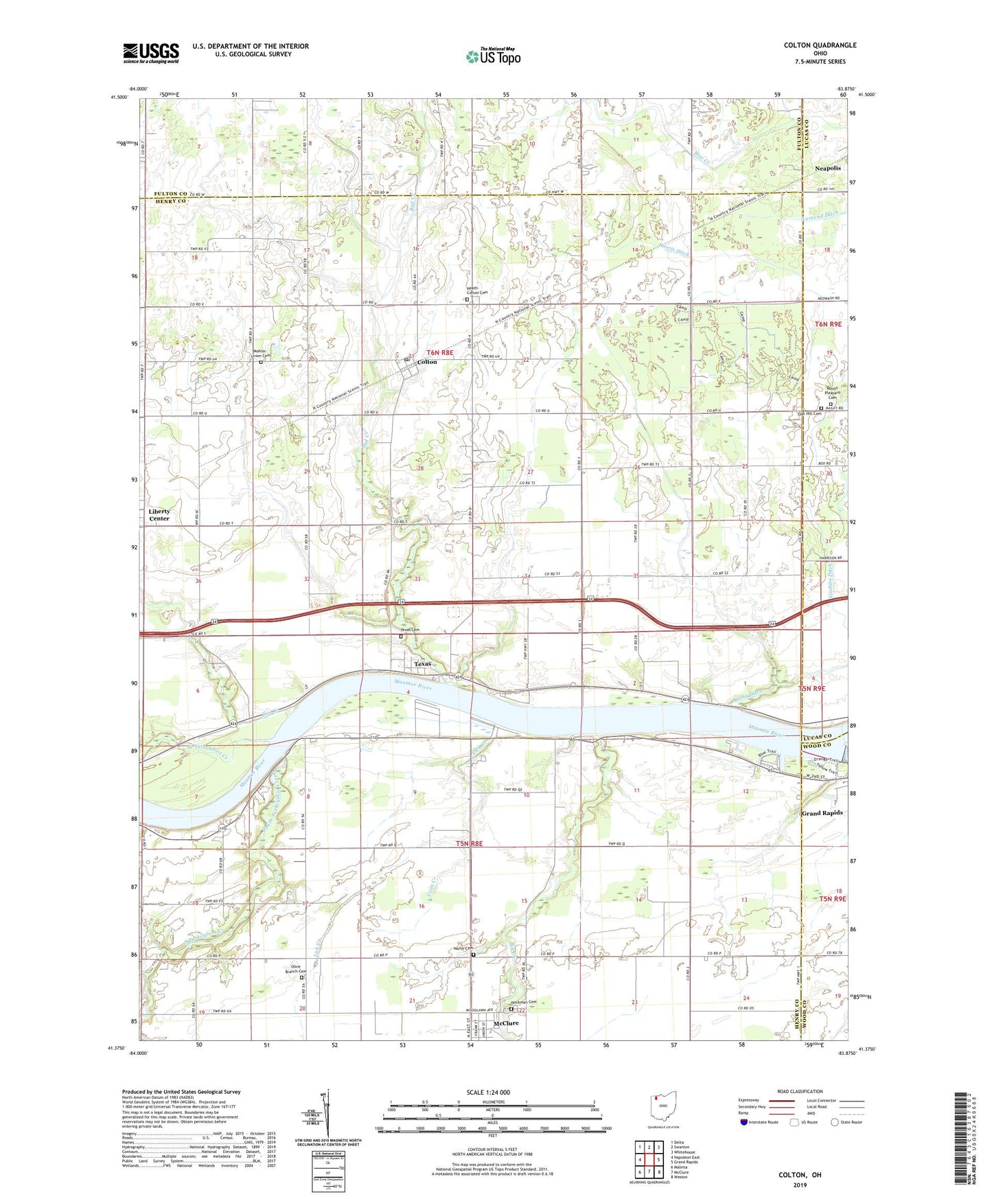
2023 topographic map quadrangle Colton in the state of Ohio. Scale: 1:24000. Based on the newly updated USGS 7.5' US Topo map series, this map is in the following counties: Henry, Fulton, Lucas, Wood. The map contains contour data, water features, and other items you are used to seeing on USGS maps, but also has updated roads and other features. This is the next generation of topographic maps. Printed on high-quality waterproof paper with UV fade-resistant inks.
Quads adjacent to this one:
West: Napoleon East
Northwest: Delta
North: Swanton
Northeast: Whitehouse
East: Grand Rapids
Southeast: Weston
South: McClure
Southwest: Malinta
This map covers the same area as the classic USGS quad with code o41083d8.
Contains the following named places: Bad Creek, Big Creek, Colton, Colton Methodist Church, Colton Post Office, Coon Creek, Damascus Christian Union Church of Christ, Dry Creek, Geahlin Ditch, Grand Rapids Dam, Heath-Colton Cemetery, Hockman Cemetery, Lick Creek, Little Turkeyfoot Creek, Maumee State Forest, Maumee Youth Center, Mohler-Union Cemetery, Mount Pleasant Cemetery, Mount Pleasant Church, North Cemetery, North Turkeyfoot Creek, North Turkeyfoot State Park, Oak Hill Cemetery, Olive Branch Cemetery, Olive Branch United Brethren in Christ Church, South Turkeyfoot Creek, Texas, Texas Cemetery, Texas Post Office, Thurston State Park, Township of Damascus, Township of Washington, Weavers Landing, Willow Haven Trailer Court, ZIP Codes: 43532, 43547