MyTopo
McClure Ohio US Topo Map
Couldn't load pickup availability
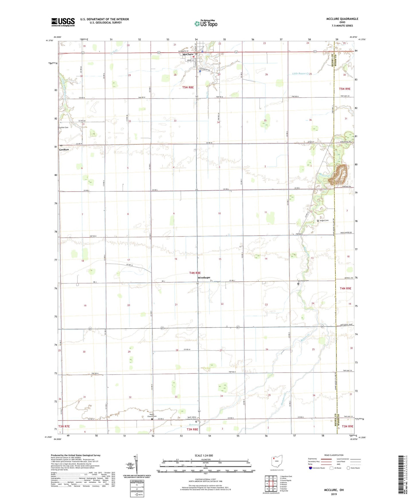
2023 topographic map quadrangle McClure in the state of Ohio. Scale: 1:24000. Based on the newly updated USGS 7.5' US Topo map series, this map is in the following counties: Henry, Wood. The map contains contour data, water features, and other items you are used to seeing on USGS maps, but also has updated roads and other features. This is the next generation of topographic maps. Printed on high-quality waterproof paper with UV fade-resistant inks.
Quads adjacent to this one:
West: Malinta
Northwest: Napoleon East
North: Colton
Northeast: Grand Rapids
East: Weston
Southeast: Hoytville
South: Deshler
Southwest: Hamler
This map covers the same area as the classic USGS quad with code o41083c8.
Contains the following named places: Angell Cemetery, Bethany Christian Union Church of Christ, Custar Stone Quarry, Damascus Township High School, Damascus Township Volunteer Fire Department, Eickmeier Airport, Grelton, Grelton Post Office, Hammer Creek, Hope School, McClure, McClure Police Department, McClure Post Office, Peace Church Cemetery, Peace Lutheran Church of Deshler, Richfield Cemetery, Saint Johns Lutheran Cemetery, Saint Johns Lutheran Church, Township of Richfield, Trinity United Brethren in Christ Church, Village of McClure, Westhope, Westhope Church, Westhope Post Office, ZIP Codes: 43523, 43534