MyTopo
Creston Ohio US Topo Map
Couldn't load pickup availability
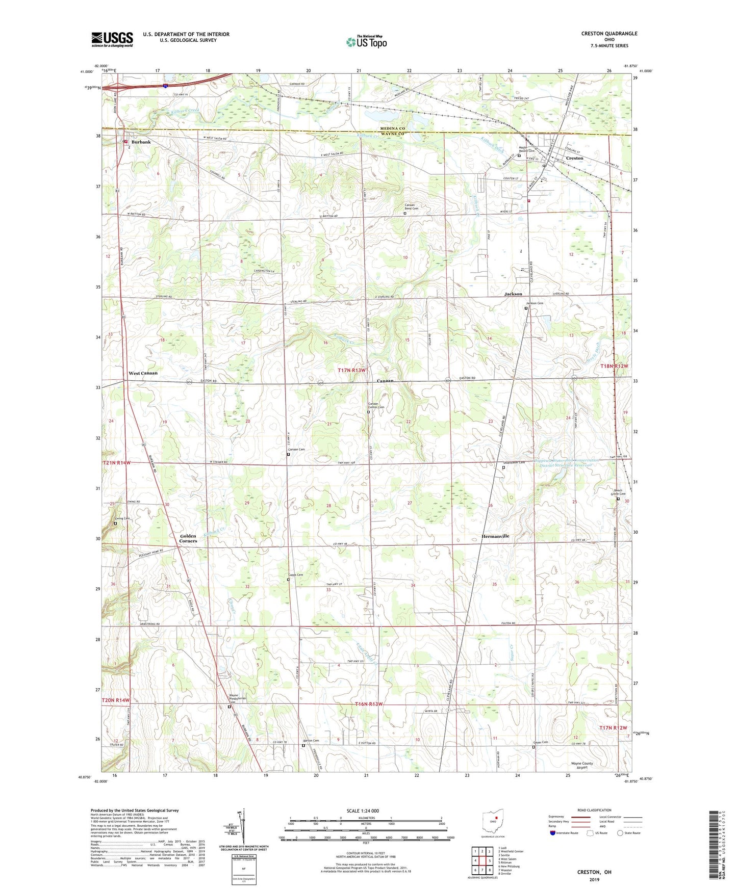
2019 topographic map quadrangle Creston in the state of Ohio. Scale: 1:24000. Based on the newly updated USGS 7.5' US Topo map series, this map is in the following counties: Wayne, Medina. The map contains contour data, water features, and other items you are used to seeing on USGS maps, but also has updated roads and other features. This is the next generation of topographic maps. Printed on high-quality waterproof paper with UV fade-resistant inks.
Quads adjacent to this one:
West: West Salem
Northwest: Lodi
North: Westfield Center
Northeast: Seville
East: Rittman
Southeast: Orrville
South: Wooster
Southwest: New Pittsburg
Contains the following named places: Barton Cemetery, Beech Grove Cemetery, Blue Ridge Farms, Burbank, Burbank Elementary School, Burbank Post Office, Camel Creek, Canaan, Canaan Bend Cemetery, Canaan Cemetery, Canaan Center Cemetery, Canaan Lutheran Church, Canaan Township Fire Department Station 1 Headquarters, Canaan Township Fire Department Station 2, Cantendo Acres, Chippewa Church of the Brethren, Chippewa Watershed Conservation District Structure Reservoir, Circle J Farms, Colvin Family Farm, Creston, Creston Middle School, Creston Post Office, Cupps Cemetery, Ewing Cemetery, Gerber Farm, Geyer Cemetery, Gill Farms, Golden Corners, Hermanville, Hoistington Farms, Indian Head Village, Jackson, Jackson Cemetery, Jackson Presbyterian Church, Killbuck Ditch, Maple Mound Cemetery, McLaughlin Farms, Moonstruck Farm, Quailcrest Farm, School Number 11, School Number 2, School Number 3, School Number 5, School Number 8, Shoemaker Cemetery, Township of Canaan, Township of Creston Village, Twin Castle Farms, Village of Burbank, Village of Creston, Wayne Presbyterian Cemetery, Wayne Presbyterian Church, West Canaan, ZIP Codes: 44214, 44217