MyTopo
Denmark Ohio US Topo Map
Couldn't load pickup availability
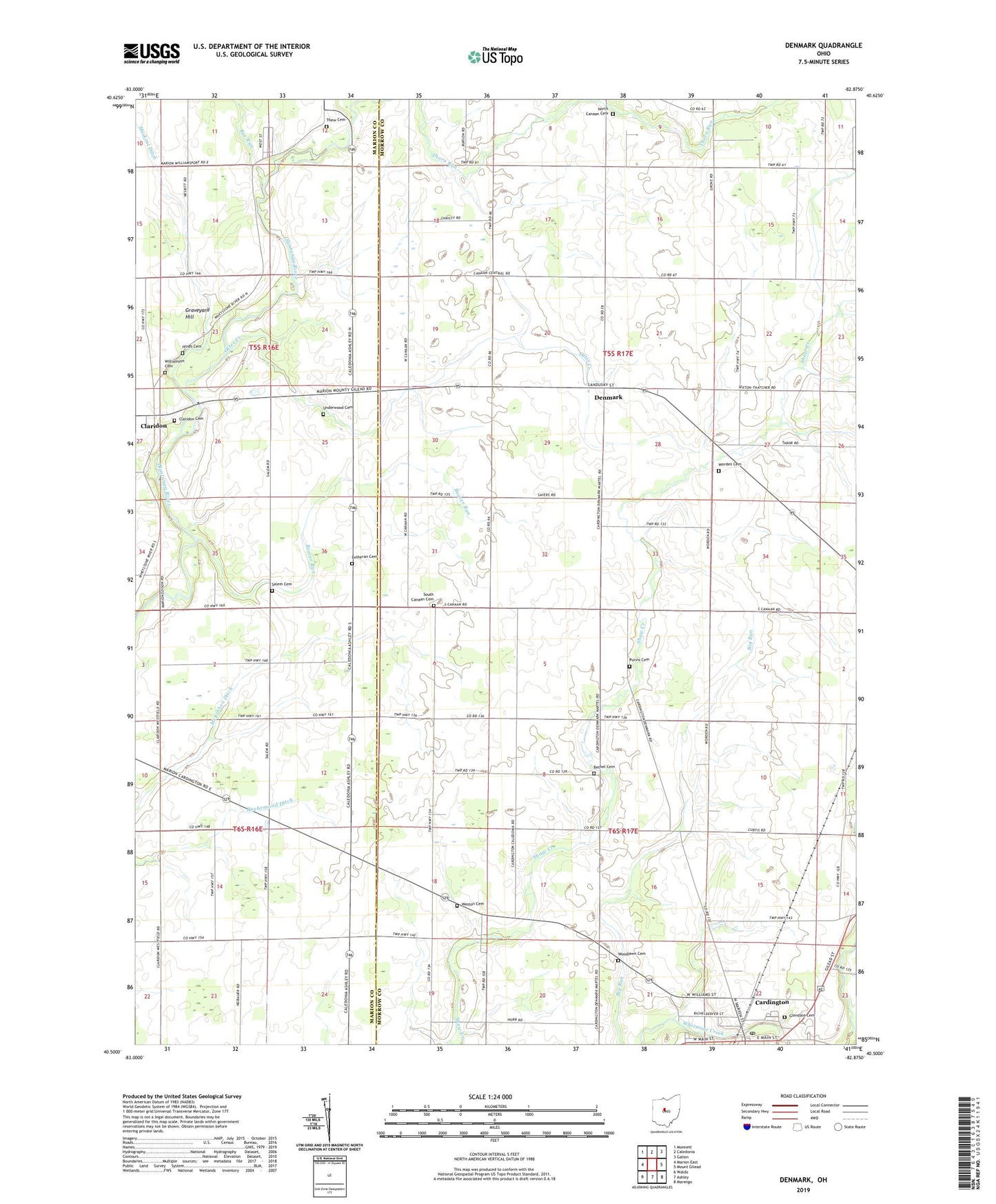
2019 topographic map quadrangle Denmark in the state of Ohio. Scale: 1:24000. Based on the newly updated USGS 7.5' US Topo map series, this map is in the following counties: Morrow, Marion. The map contains contour data, water features, and other items you are used to seeing on USGS maps, but also has updated roads and other features. This is the next generation of topographic maps. Printed on high-quality waterproof paper with UV fade-resistant inks.
Quads adjacent to this one:
West: Marion East
Northwest: Monnett
North: Caledonia
Northeast: Galion
East: Mount Gilead
Southeast: Marengo
South: Ashley
Southwest: Waldo
Contains the following named places: Beaver Run, Bee Run, Beech, Beech Grove School, Bethel Cemetery, Bethel Church, Bethel School, Cardington, Claridon, Claridon Cemetery, Claridon Post Office, Davis School, Denmark, Egypt School, Gable School, Glendale Cemetery, Graveyard Hill, Hardscrabble School, Hickory Corner School, Hinds Cemetery, Klinefelter School, Long School, Lutheran Cemetery, McKibben Ditch, Muskrat Ditch, North Canaan Cemetery, Otter Creek, Purvis Cemetery, Rainbow Mobile Home Park, Ruehrmond Ditch, Russell School, Saint Paul Evangelical Lutheran Church, Salem Cemetery, Salem Evangelical Church, Salem School, South Canaan Cemetery, Thew Cemetery, Township of Canaan, Township of Cardington, Underwood Cemetery, West Salem School, Weston Cemetery, Weston School, Williamson Cemetery, Wood Valley, Woodlawn Cemetery, Worden Cemetery, Worden School, ZIP Code: 43320