MyTopo
Dover Ohio US Topo Map
Couldn't load pickup availability
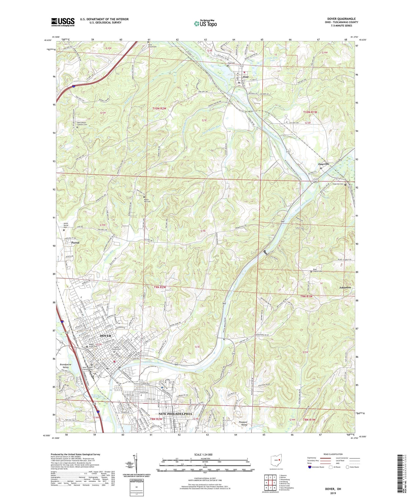
2023 topographic map quadrangle Dover in the state of Ohio. Scale: 1:24000. Based on the newly updated USGS 7.5' US Topo map series, this map is in the following counties: Tuscarawas. The map contains contour data, water features, and other items you are used to seeing on USGS maps, but also has updated roads and other features. This is the next generation of topographic maps. Printed on high-quality waterproof paper with UV fade-resistant inks.
Quads adjacent to this one:
West: Strasburg
Northwest: Navarre
North: Bolivar
Northeast: Waynesburg
East: Mineral City
Southeast: Uhrichsville
South: New Philadelphia
Southwest: Stone Creek
This map covers the same area as the classic USGS quad with code o40081e4.
Contains the following named places: Bender School, Bisel Church Cemetery, Bisel United Methodist Church, Bissels School, Brandywine Creek, Brandywine Valley, Camp Tuscazoar, Candlelight Villas, Christian and Missionary Alliance Church, Church of Christ, City of Dover, City of Dover Sewage Treatment Plant, Community Baptist Chapel, Conotton Creek, Crater Stadium, Diversion Dam Lake, Dover, Dover Avenue Elementary School, Dover Baptist Temple, Dover Bethel Chapel, Dover Bible Church, Dover Burial Park, Dover Church of Christ, Dover City Hall, Dover Dam, Dover Electric Light Plant, Dover Fire Department, Dover High School, Dover Industrial Park, Dover Lake, Dover Police Department, Dover Post Office, Dover Public Library, East Elementary School, Faith United Methodist Church, First Baptist Church, First Christian Church, First Church of God, First Methodist Church, First Moravian Church, First United Brethren Church, First United Methodist Church, Foursquare Gospel Church, Fourth Street Cemetery, Goettge Run, Grace Lutheran Church, Grace School, Heritage Village, Honey Run School, Huff Run, Kline Grove Cemetery, Krantz Berry Farm, Lime Kiln Lake, Maple Grove Cemetery, Memorial Hall, Middle Run, Miracle Lane Plaza Shopping Center, Monroe Mall Shopping Center, Nazarene Temple, New England, Oak Grove School, Park Elementary School, Parral, Parral Post Office, Penobscot School, Pleasant Valley, Public Square, Quaker Stadium, Reeds Run, Ruslin Hill Cemetery, Saint Johns United Church of Christ, Saint Josephs Catholic Church, Saint Josephs Cemetery, Saint Josephs Elementary School, Saint Marks African Methodist Episcopal Zion Church, Saint Pauls Church, Saint Peters Catholic Cemetery, Saint Peters Church, Second Moravian Church, Slingluff Park, Small Middle Run, Smith Ambulance Service, South Elementary School, South Moravian Church, Sugar Creek, Sun Valley Airport, Tabor School, Township of Dover, Township of Lawrence, Tuscarawas Avenue Elementary School, Tuscarawas County Childrens Home, Tuscarawas County Fairgrounds, Tuscarawas Valley High School, Tuscarawas Valley Middle School, Tuscora Park, Union Country Club, Union Hospital, Union Hospital Heliport, Unity Grange, Valley Junction, Village of Parral, Village of Zoar, Warther Museum, Willow Glen, WJER-AM (Dover-New Philadelphia), WNPQ-FM (New Philadelphia), Wolf Run, Zion African Methodist Episcopal Church, Zoar, Zoar Cemetery, Zoar Historic District, Zoar Lake, Zoar Levee Diversion Dam, Zoar Post Office, Zoar Station, Zoar Village Golf Course, Zoar Volunteer Fire Department, Zoar Wildlife Area, Zoarsville Post Office, Zoarville, Zoarville Cemetery, ZIP Codes: 44622, 44697


