MyTopo
Uhrichsville Ohio US Topo Map
Couldn't load pickup availability
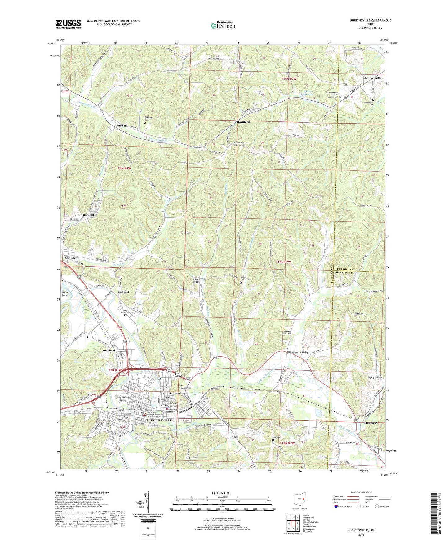
2023 topographic map quadrangle Uhrichsville in the state of Ohio. Scale: 1:24000. Based on the newly updated USGS 7.5' US Topo map series, this map is in the following counties: Tuscarawas, Carroll, Harrison. The map contains contour data, water features, and other items you are used to seeing on USGS maps, but also has updated roads and other features. This is the next generation of topographic maps. Printed on high-quality waterproof paper with UV fade-resistant inks.
Quads adjacent to this one:
West: New Philadelphia
Northwest: Dover
North: Mineral City
Northeast: Dellroy
East: Bowerston
Southeast: Deersville
South: Tippecanoe
Southwest: Gnadenhutten
This map covers the same area as the classic USGS quad with code o40081d3.
Contains the following named places: Baldwin School, Barnhill, Barnhill Post Office, Big Bend Golf Course, Big Bend School, Calvary Cemetery, Central Park, Christian Temple, City of Uhrichsville, Claymont High School, Claymont Middle School, Claymont Shopping Center, Claymont Stadium, Crook School, Dennison, Dennison Fire Department, Dennison Foursquare Church, Dennison Police Department, Dennison Post Office, Dennison Stadium, Eastport, Eastport Post Office, Eastport School, Happy Hollow, Healey School, Indian Hill, Irish Run, John F Kennedy Memorial Park, Kingdom Hall, Liberty Cemetery, Lighthouse Church, Little Stillwater Creek, Maple Grove School, Maurer Trailer Park, Midvale, Midvale Church of God, Midvale Community Park, Midvale Station, Moose Island, Mount Bethel Church, Oak School, Park Elementary School, Pleasant Valley, Pleasant Valley Cemetery, Pleasant Valley Church, Pleasant Valley School, Pone Run, Prosperity Grange Hall, Roanoake, Rockford, Rockford Post Office, Roswell, Roswell Post Office, Roxford Airport, Roxford Methodist Episcopal Cemetery, Roxford United Methodist Church, Saint Elizabeth Cemetery, Saint Elizabeth Church, Saint Marys Cemetery, Saint Marys Elementary School, Sherrodsville Cemetery, Sherrodsville Memorial Gardens Cemetery, Sherrodsville Volunteer Fire Department, South Side Park, Southside Gospel Chapel, Spring Hill Lake, Station 15, Station Post Office, Stillwater Creek, Sunny Hollow School, Ten Lakes Center, Thornwood Park, Three Legs Town, Township of Goshen, Township of Mill, Township of Union, Trenton Avenue Elementary School, Trinity Hospital Twin City, Uhrichsville, Uhrichsville Fire Department, Uhrichsville Police Department, Uhrichsville Post Office, Union Cemetery, Village of Barnhill, Village of Dennison, Village of Midvale, Village of Roswell, WBTC Radio Tower, WBTC-AM (Uhrichsville), Wesley Chapel Cemetery, Wesley Church, Wolf Run, ZIP Codes: 44621, 44653