MyTopo
Elkton Ohio US Topo Map
Couldn't load pickup availability
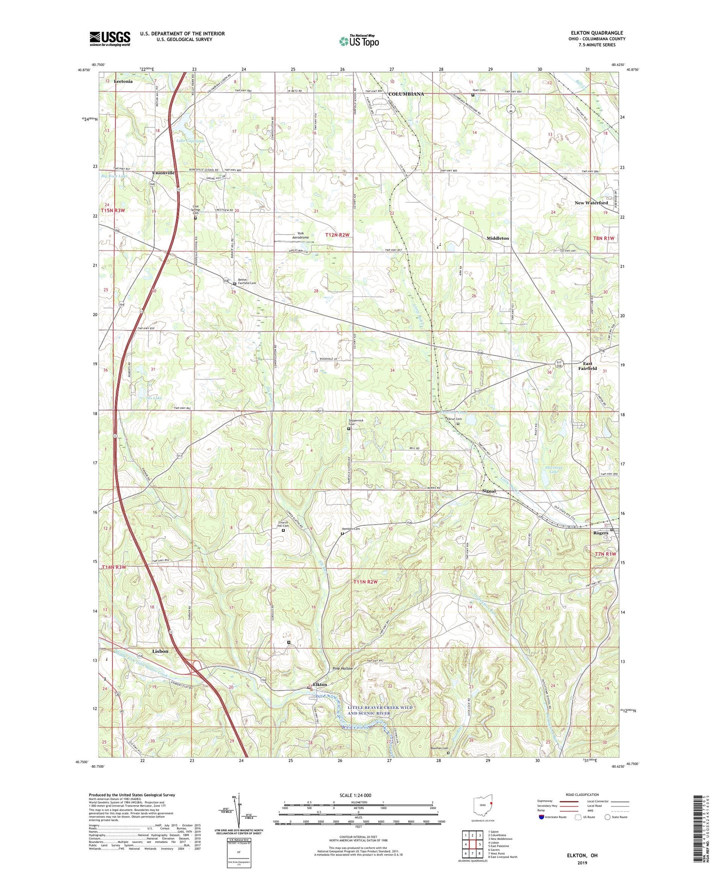
2023 topographic map quadrangle Elkton in the state of Ohio. Scale: 1:24000. Based on the newly updated USGS 7.5' US Topo map series, this map is in the following counties: Columbiana. The map contains contour data, water features, and other items you are used to seeing on USGS maps, but also has updated roads and other features. This is the next generation of topographic maps. Printed on high-quality waterproof paper with UV fade-resistant inks.
Quads adjacent to this one:
West: Lisbon
Northwest: Salem
North: Columbiana
Northeast: New Middletown
East: East Palestine
Southeast: East Liverpool North
South: West Point
Southwest: Gavers
This map covers the same area as the classic USGS quad with code o40080g6.
Contains the following named places: Als Lake, Bethel - Fairfield Cemetery, Bowman Cemetery, Church Hill Cemetery, Church Hill Church, Cool Springs Cemetery, Copeland Hills Golf Course, East Fairfield, East Fairfield Post Office, East Fairfield United Methodist Church, Elk Run, Elkrun Cemetery, Elkton, Elkton Post Office, Federal Correctional Institution Elkton, Hays Orchard, Heston, Hum Cemetery, Kembles Cemetery, Lake Copeland, Lake Copeland Dam, Middle Run, Middleton, Mints Pine Acres Lake Dam, Newhouse, Ohio State Highway Patrol - Lisbon Patrol Post, Peterson Pond, Peterson Pond Dam, Pine Hollow, Rogers, Rogers Post Office, Saratoga, Shiveleys Lake, Signal, Signal Post Office, Sunshine Mobile Home Park, Township of Elkrun, Township of Fairfield, Unionville, Unkefer Dairy Farn, Village of Rogers, York Aerodrome, Zeppernick Cemetery, ZIP Code: 44431