MyTopo
Glenmore Ohio US Topo Map
Couldn't load pickup availability
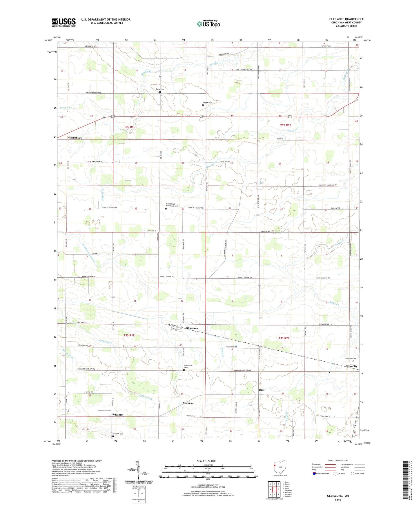
2019 topographic map quadrangle Glenmore in the state of Ohio. Scale: 1:24000. Based on the newly updated USGS 7.5' US Topo map series, this map is in the following counties: Van Wert. The map contains contour data, water features, and other items you are used to seeing on USGS maps, but also has updated roads and other features. This is the next generation of topographic maps. Printed on high-quality waterproof paper with UV fade-resistant inks.
Quads adjacent to this one:
West: Wren
Northwest: Dixon
North: Convoy
Northeast: Scott
East: Van Wert
Southeast: Mendon
South: Rockford
Southwest: Willshire
Contains the following named places: Abanaka, Abanaka Post Office, Antioch Church, Aurora Borealis Farms, Balyeat Cemetery, Balyeat Ditch, Bebout Farms, Buckeye Acres Family Farms, Darn - Dom Farms, Dull, Dull Post Office, Edwards Farm, Eickholt Farms, Etzler Farm, Evangelical Protestant Cemetery, Gamble Family Farms, Gar Bar Farms, Gardner Green Farm, German School, Germann Farms, Gina Dairy, Glenmore, Glenmore Post Office, Glenn Cemetery, Greenbriar Cemetery, Greenbrier Church, Heller School, Hileman Farm, Hoverman Ditch, Johns School, Jones Farm, Kerns Farms, Kiehl Farms, Kreider School, L and S Farm, Liberty Church, Liberty School, Lillick Ditch, Middlebury, Mount Zion Church, Norman Farm, Pleasant Elementary School, Pleasant Grove Church, Riley Farms, Roller Creek, Royston School, Saint Thomas School, School Number 1, School Number 2, School Number 5, Schumm, Schumm Cemetery, Schumm Farms, Schumm Post Office, Sheets Ditch, Township of Harrison, Township of Liberty, Township of Pleasant, Township of Willshire, Walters School, Wiseman School, Wolfe School, Woodlawn Cemetery, Zion Lutheran Church, ZIP Code: 45874