MyTopo
Wren Ohio US Topo Map
Couldn't load pickup availability
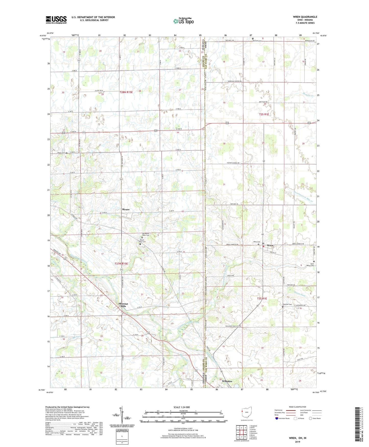
2023 topographic map quadrangle Wren in the states of Indiana, Ohio. Scale: 1:24000. Based on the newly updated USGS 7.5' US Topo map series, this map is in the following counties: Van Wert, Adams. The map contains contour data, water features, and other items you are used to seeing on USGS maps, but also has updated roads and other features. This is the next generation of topographic maps. Printed on high-quality waterproof paper with UV fade-resistant inks.
Quads adjacent to this one:
West: Decatur
Northwest: Hoagland
North: Dixon
Northeast: Convoy
East: Glenmore
Southeast: Rockford
South: Willshire
Southwest: Berne
This map covers the same area as the classic USGS quad with code o40084g7.
Contains the following named places: Blue Creek, Bowen Ditch, Brumback Library Wren Branch, Burkhart Farm, Callow Farms, Calvary Evangelical Church, Crestview South Elementary School, Decatur Hi-Way Airport, Fegley Farms, Fletcher Cemetery, Haljoro Farms, Harker School, Immanuel School, Martz Creek, McClure Cemetery, Mosier School, Mount Tabor Cemetery, Old Mount Tabor Cemetery, Pleasant Mills, Pleasant View Church, Rivare, Saint Marys Cemetery, Salem Cemetery, Sprunger Farm, Township of Saint Marys, Triple L Farms, Twentyseven Mile Creek, Village of Wren, Wood Chapel, Workinger Farms, Wren, Wren Cemetery, Wren Church, Wren Fire Department and Emergency Medical Services Department, Wren Post Office, ZIP Code: 45899