MyTopo
Convoy Ohio US Topo Map
Couldn't load pickup availability
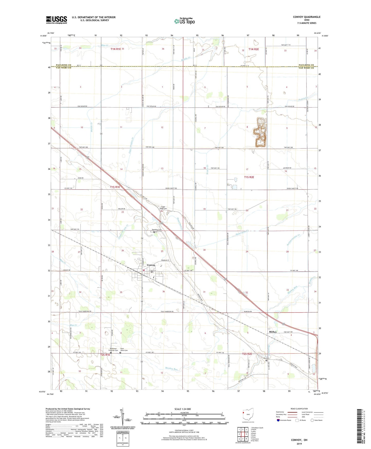
2023 topographic map quadrangle Convoy in the state of Ohio. Scale: 1:24000. Based on the newly updated USGS 7.5' US Topo map series, this map is in the following counties: Van Wert, Paulding. The map contains contour data, water features, and other items you are used to seeing on USGS maps, but also has updated roads and other features. This is the next generation of topographic maps. Printed on high-quality waterproof paper with UV fade-resistant inks.
Quads adjacent to this one:
West: Dixon
Northwest: Woodburn South
North: Payne
Northeast: Latty
East: Scott
Southeast: Van Wert
South: Glenmore
Southwest: Wren
This map covers the same area as the classic USGS quad with code o40084h6.
Contains the following named places: Arts Dairy, Asbury Church, Brumback Library Convoy Branch, Burley Farms, Convoy, Convoy Fire Station and Emergency Medical Services Department, Convoy Post Office, Convoy Union Junior High School, Crestview High School, Crestview North Elementary School, Davis School, Dix Cemetery, Dix School, Edgewood Park, Fairview Church, Friends Church, Gunsett School, IOOF Cemetery, Macabob Farms, Marcarl Farms, McClure School, Middle Creek, Monkey Run, Pleasant Chapel, Redeemer Lutheran Cemetery, Reidenbach School, Richey, Robinson School, Saint Johns Cemetery, Saint Johns School, School Number 1, School Number 2, School Number 3, School Number 4, School Number 5, School Number 9, Scott Quarry, Shook School, Speelman Farm, Storm Ditch, Sugar Grove Church, Sugar Ridge Cemetery, Sugar Ridge Church, Swick School, Thompson Farm, Township of Tully, Township of Union, Upper Prairie Creek, Village of Convoy, Web Ditch, West Fork Ditch, ZIP Code: 45832