MyTopo
Greenwich Ohio US Topo Map
Couldn't load pickup availability
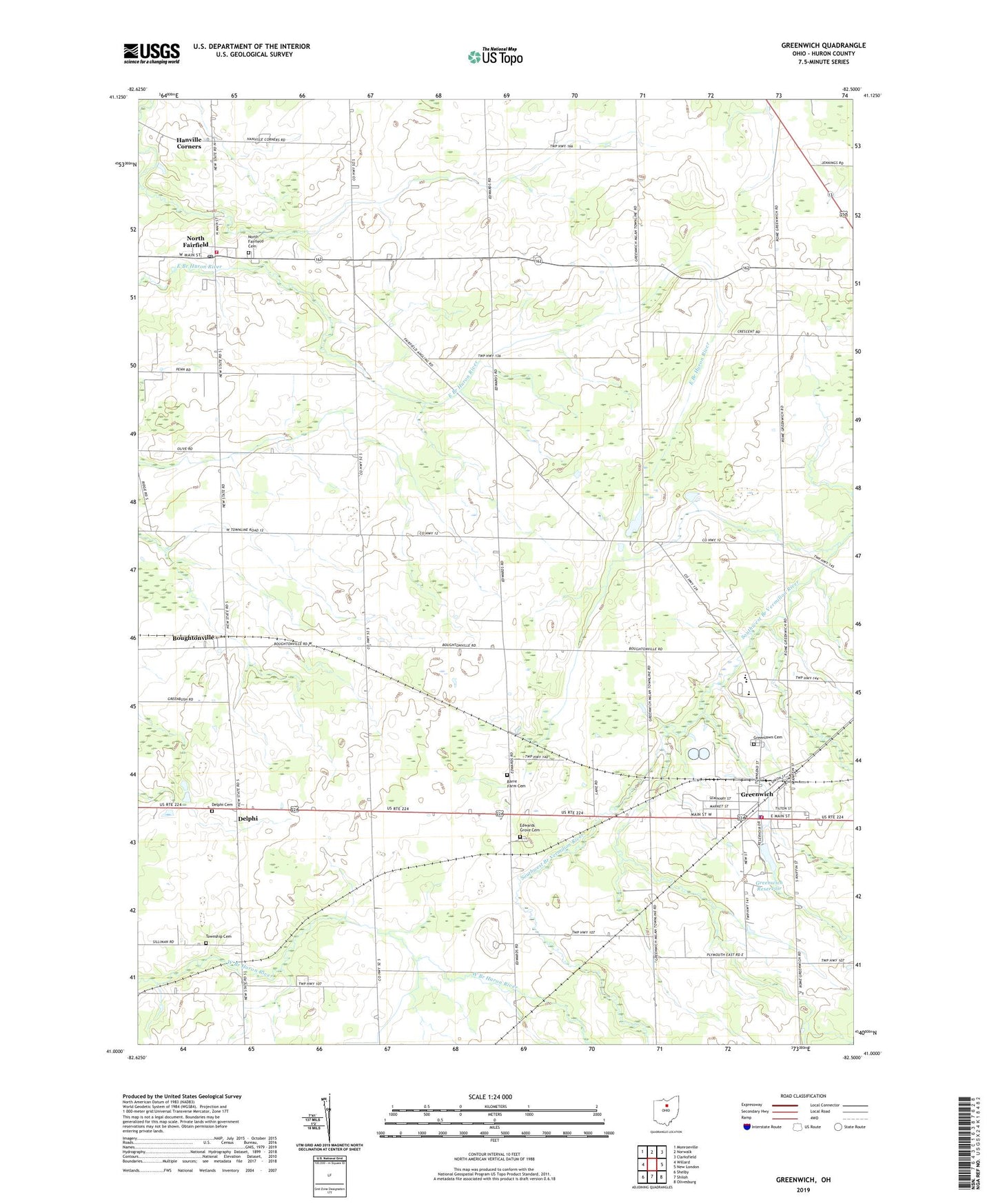
2019 topographic map quadrangle Greenwich in the state of Ohio. Scale: 1:24000. Based on the newly updated USGS 7.5' US Topo map series, this map is in the following counties: Huron. The map contains contour data, water features, and other items you are used to seeing on USGS maps, but also has updated roads and other features. This is the next generation of topographic maps. Printed on high-quality waterproof paper with UV fade-resistant inks.
Quads adjacent to this one:
West: Willard
Northwest: Monroeville
North: Norwalk
Northeast: Clarksfield
East: New London
Southeast: Olivesburg
South: Shiloh
Southwest: Shelby
Contains the following named places: Barre Farm Cemetery, Boughtonville, Boughtonville Post Office, Branchwood Estates, Delphi, Delphi Cemetery, Edwards Grove Cemetery, Fairfield Emergency Medical Services, Greenlawn Cemetery, Greenwich, Greenwich Police Department, Greenwich Post Office, Greenwich Reservoir, Hanville Corners, North Central Emergency Medical Services, North Fairfield, North Fairfield Cemetery, North Fairfield Post Office, North Fairfield Volunteer Fire Department, Oney's Milkyway Farm, Reservoir Park, Ripley School, School Number 4, School Number 5, School Number 7, School Number 9, South Central Elementary School, South Central High School, South Central Middle School, Township Cemetery, Township of Fairfield, Township of Ripley, Tri - Community Joint Fire Department, Village of Greenwich, Village of North Fairfield, ZIP Code: 44855