MyTopo
Shiloh Ohio US Topo Map
Couldn't load pickup availability
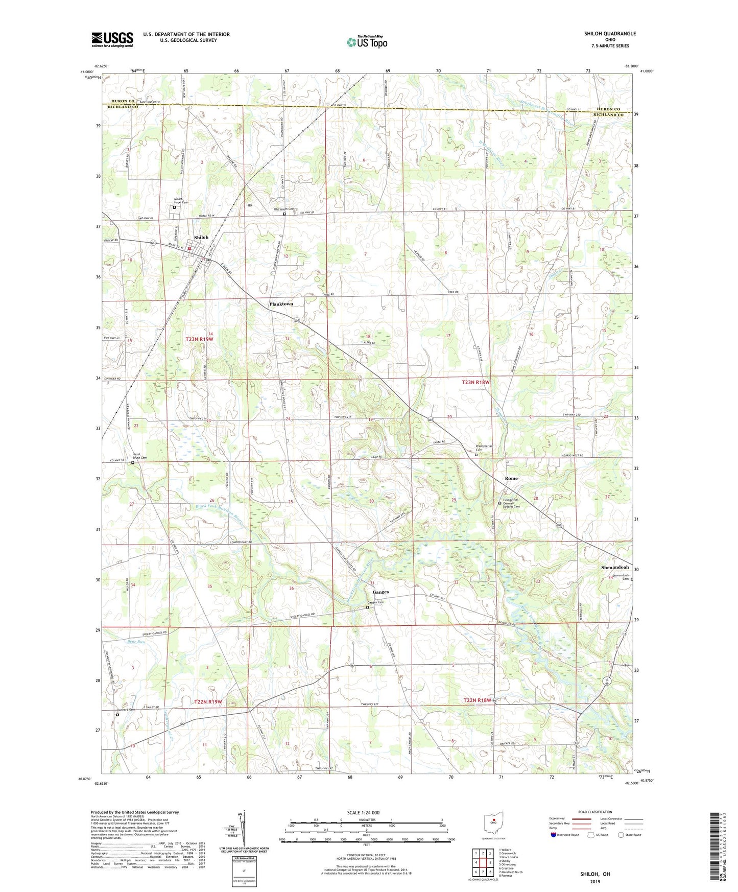
2023 topographic map quadrangle Shiloh in the state of Ohio. Scale: 1:24000. Based on the newly updated USGS 7.5' US Topo map series, this map is in the following counties: Richland, Huron. The map contains contour data, water features, and other items you are used to seeing on USGS maps, but also has updated roads and other features. This is the next generation of topographic maps. Printed on high-quality waterproof paper with UV fade-resistant inks.
Quads adjacent to this one:
West: Shelby
Northwest: Willard
North: Greenwich
Northeast: New London
East: Olivesburg
Southeast: Pavonia
South: Mansfield North
Southwest: Crestline
This map covers the same area as the classic USGS quad with code o40082h5.
Contains the following named places: Bevier Farms, Cass Blooming Grove and Shiloh Fire Department, Evangelical German Reform Cemetery, Ganges, Ganges Cemetery, Ganges Post Office, Hazel Brush Cemetery, Leatherwood Creek, London Cemetery, Mount Hope Cemetery, Old Salem Cemetery, Planktown, Presbyterian Cemetery, Rome, Saint Peters Church, School Number 2, School Number 3, School Number 5, School Number 7, Shenandoah Cemetery, Shiloh, Shiloh Elementary School, Shiloh Middle School, Shiloh Post Office, Shipp Creek, Springmills Post Office, Township of Bloominggrove, Township of Cass, Village of Shiloh, White Hall Church, ZIP Code: 44878