MyTopo
Shelby Ohio US Topo Map
Couldn't load pickup availability
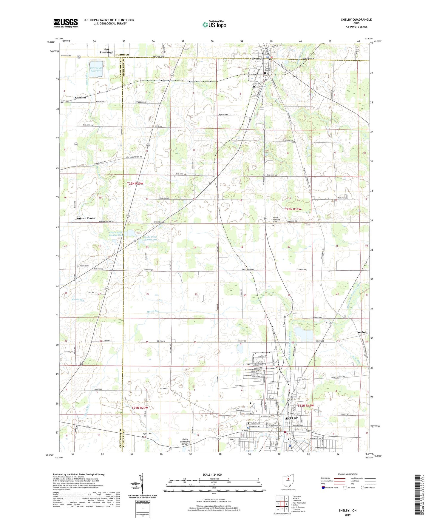
2023 topographic map quadrangle Shelby in the state of Ohio. Scale: 1:24000. Based on the newly updated USGS 7.5' US Topo map series, this map is in the following counties: Richland, Crawford, Huron. The map contains contour data, water features, and other items you are used to seeing on USGS maps, but also has updated roads and other features. This is the next generation of topographic maps. Printed on high-quality waterproof paper with UV fade-resistant inks.
Quads adjacent to this one:
West: New Washington
Northwest: Centerton
North: Willard
Northeast: Greenwich
East: Shiloh
Southeast: Mansfield North
South: Crestline
Southwest: North Robinson
This map covers the same area as the classic USGS quad with code o40082h6.
Contains the following named places: Auburn Center, Auburn Elementary School, Basswood School, Bear Run, Blackman School, Calvary Chapel, Capri Mobile Home Park, Carefree Estates, Castamba Theater, Celeryville Reservoir, Celeryville Upground Reservoir Dam, Central Elementary School, Central Ohio Industrial Park, Cherwood Farms, City of Shelby, City of Shelby Waste Water Treatment Plant, City of Shelby Water Treatment Plant, Cooke Pond Dam Number One, Cooke Pond Dam Number Two, Cooke Pond Number One, Cooke Pond Number Two, Easterling Park, First Christian Church, First Lutheran Church, First Presbyterian Church, First United Church of Christ, First United Presbyterian Church, Forest, Fry Farm, Gardner, Green Lawn Cemetery, Hanna Cemetery, Hazel Brush School, Kuhn School, London, Maple Grove School, Marsh Run, Marsh Run School, McBride Park, Most Pure Heart of Mary Catholic Church, Mount Pleasant Cemetery, Myers Cemetery, New Pittsburgh, Pine Grove Mobile Estates, Pioneer Joint Vocational School, Pioneer Rest Cemetery, Plymouth, Plymouth Fire Department, Plymouth High School, Plymouth Police Department, Plymouth Post Office, Plymouth United Methodist Church, Rabold Park, Saint Marks Episcopal Church, School Number 1, School Number 2, School Number 4, School Number 6, Seltzer Park, Shelby, Shelby Center Historic District, Shelby City Hall, Shelby Community Airport, Shelby High School, Shelby Hospital, Shelby Junction, Shelby Junior High School, Shelby Middle School, Shelby Mobile Home Park, Shelby Municipal Court, Shelby Municipal Light Plant, Shelby Police Department, Shelby Post Office, Skiles Field, Township of Plymouth, Updyke School, Veterans Park, Village of Plymouth, Whitney School, Wilkins Air Force Station, Woody Ridge Golf Course, WPJV-FM (Willard), WSWR-FM (Shelby), ZIP Codes: 44865, 44875